German Brands on the Map
From BMW and Bosch to Aldi and Allianz, Germany is home to some of the world’s most famous and trusted brands. A map brings these brands together to show where the most valuable German companies are based.
Read More
From BMW and Bosch to Aldi and Allianz, Germany is home to some of the world’s most famous and trusted brands. A map brings these brands together to show where the most valuable German companies are based.
Read More
A visual tour of Italy’s most recognizable brands reveals more than just logos; it also reveals the distinctive fusion of innovation, tradition, and style that powers some of the most adored businesses in the world.
Read More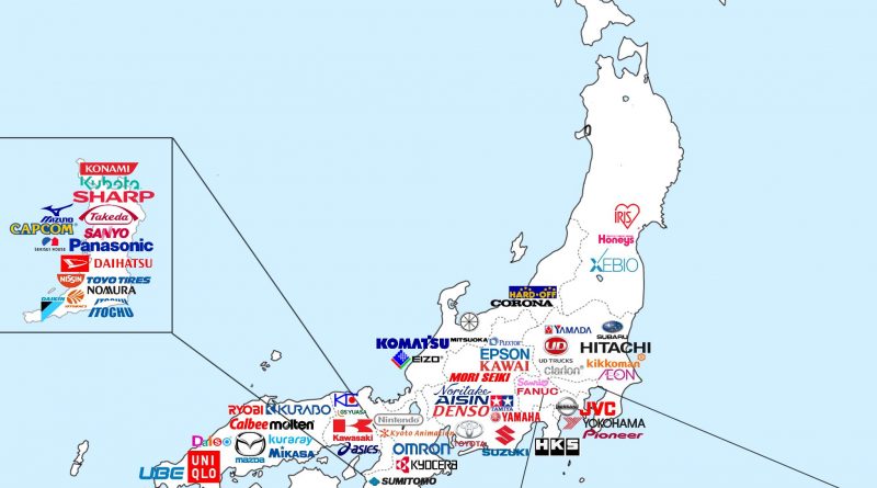
Map of Japan picks out the headquarters of its most valuable brands, offering a new perspective on the economic geography and regional brand distribution of the nation.
Read More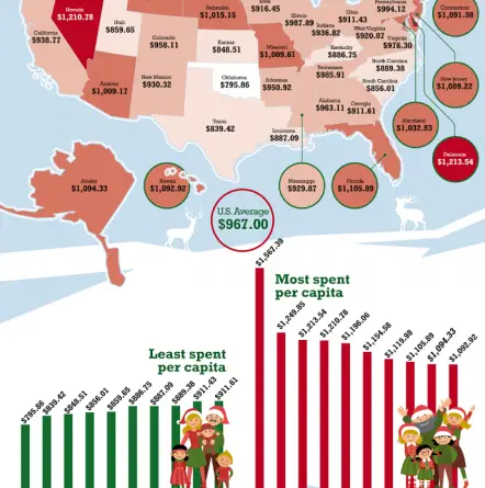
www.titlemax.com Most spent per capita 1.New Hampshire – $1,567.39 2. Vermont – $1,249.85 3. Delaware – $1,213.54 4. Nevada –
Read More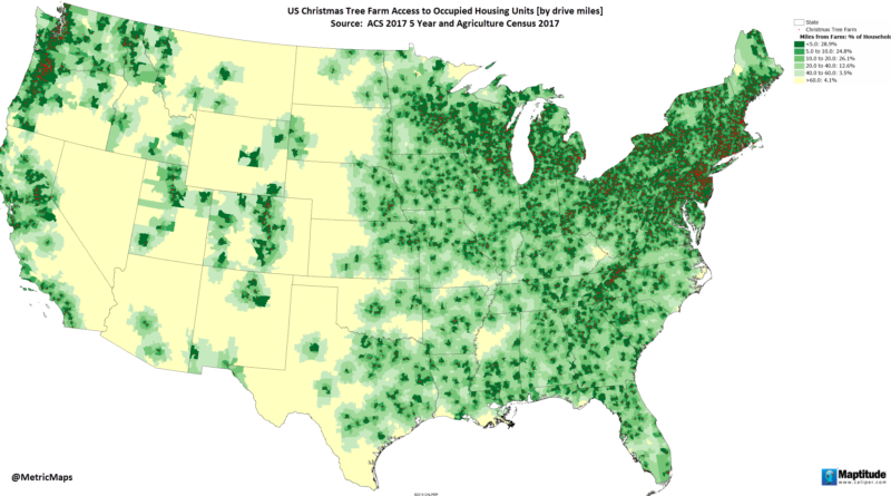
wo states grow nearly two-thirds of America’s Christmas trees, but the geography gets even more specific than that. When you zoom into county-level data, a handful of places emerge as the real centers of this seasonal industry.
Read MoreLargest Industry in Each U.S. State: NORTH DAKOTA – Oil and gas extraction (Industry output as % of GDP: 7.5%)
Read More
The United States is home to five of the top ten cities with the largest billionaires in the world. 6 U.S. states have billionaires with over $50 billion in net worth. The maps below show the richest people in every american state.
Read More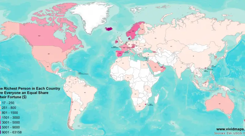
www.vividmaps.com Related post: – If the Richest Person in Each US State Gave Everyone an Equal Share of their Fortune
Read More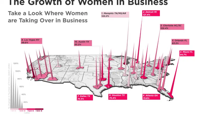
The Top 10 U.S. Cities For Women-Owned Businesses
Read MoreSource: goldeagle.com
Read More