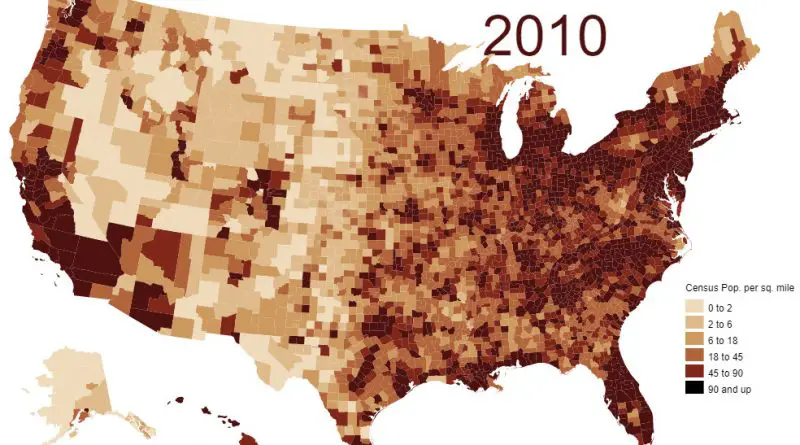
US Population Growth Mapped
A visual and analytical journey through America’s population changes, highlighting key historical moments and demographic shifts.
Read MoreHistorical maps showing territorial changes of countries and historical events of the past.
A visual and analytical journey through America’s population changes, highlighting key historical moments and demographic shifts.
Read More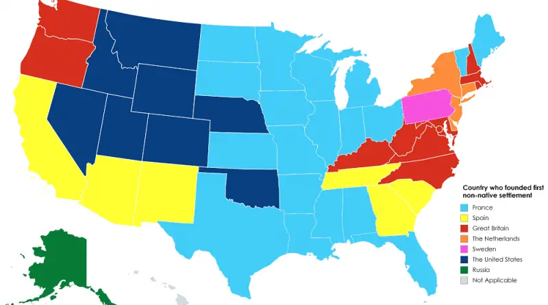
Before the U.S. existed, global powers raced to plant their flags on its land. This map shows the first foreign country to settle in each U.S. state, with the fascinating mix of empires that once dreamed of ruling America.
Read More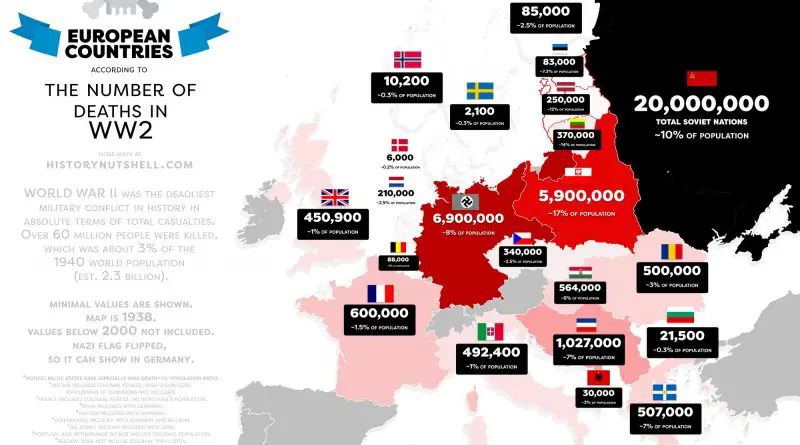
An in-depth analysis of World War II’s unprecedented human cost, examining the conflict’s impact across continents through compelling maps and historical data.
Read More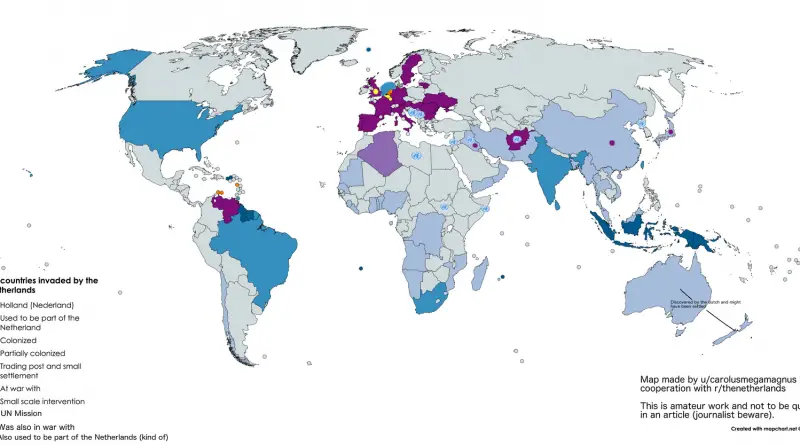
How did such a small country reach so many parts of the world? A historical map shows the global footprint of Dutch expansion — from colonial outposts to trade wars.
Read More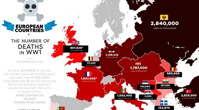
Examining the devastating toll of WWI through carefully curated maps and data, showing how military casualties and subsequent food shortages transformed the European continent.
Read More
Slavery in the Americas began with the arrival of the first Africans, who were primarily imported by Spain and Portugal. This brutal practice expanded significantly with the establishment of sugar plantations in Brazil and spread throughout the continent. Millions of Africans were forcibly brought to the Americas, shaping the economic and social foundations of the New World by the 18th century.
Read More
Did Stalin really plan to conquer the world? A 1952 magazine map claimed to reveal his Cold War strategy. Explore the history, the defector’s claims, and why the map still sparks debate today.
Read More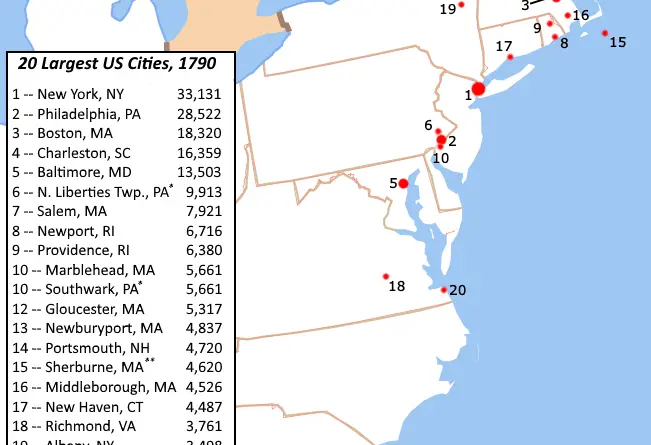
Most of America’s biggest cities in 1790 were coastal New England ports – all built around fishing, shipping, and trade.
Read More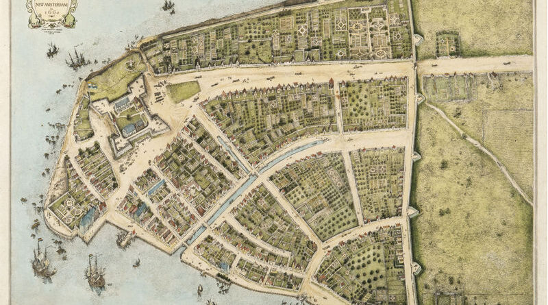
Manhattan below City Hall is 50% larger than in the 1620s. Maps show the Heere Gracht canal (1626-1676), English water lots that added 500 acres by 1776, Castle Clinton built 300 feet offshore in 1808, Egbert Viele’s 1865 map showing landfill extent, Battery Park City’s 92 acres from World Trade Center excavation (1968-1976), and T. Kennard Thomson’s 1911 plan to dam the East River.
Read MoreBetween 1378 and 1417, three men simultaneously claimed to be pope. European kingdoms divided over allegiances to Rome, Avignon, and Pisa, driven purely by political interests rather than religious disagreements.
Read More