America’s Biggest Towns in 1790
Most of America’s biggest cities in 1790 were coastal New England ports – all built around fishing, shipping, and trade.
Read more: America’s Biggest Towns in 1790
Historical maps showing territorial changes of countries and historical events of the past.
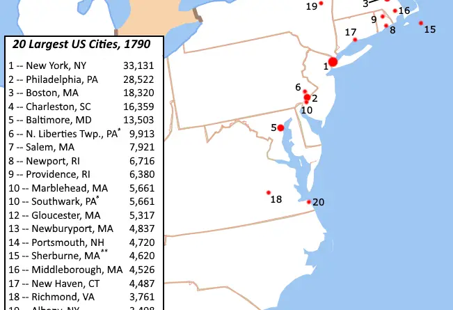
Most of America’s biggest cities in 1790 were coastal New England ports – all built around fishing, shipping, and trade.
Read more: America’s Biggest Towns in 1790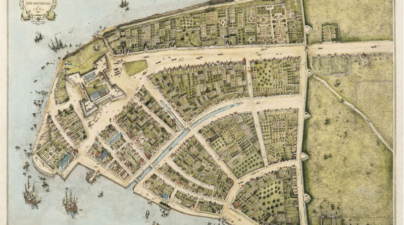
Manhattan below City Hall is 50% larger than in the 1620s. Maps show the Heere Gracht canal (1626-1676), English water lots that added 500 acres by 1776, Castle Clinton built 300 feet offshore in 1808, Egbert Viele’s 1865 map showing landfill extent, Battery Park City’s 92 acres from World Trade Center excavation (1968-1976), and T. Kennard Thomson’s 1911 plan to dam the East River.
Read more: The Changing Shoreline of New York CityBetween 1378 and 1417, three men simultaneously claimed to be pope. European kingdoms divided over allegiances to Rome, Avignon, and Pisa, driven purely by political interests rather than religious disagreements.
Read more: When the Catholic Church Had Three Popes: The Western Schism of 1378-1417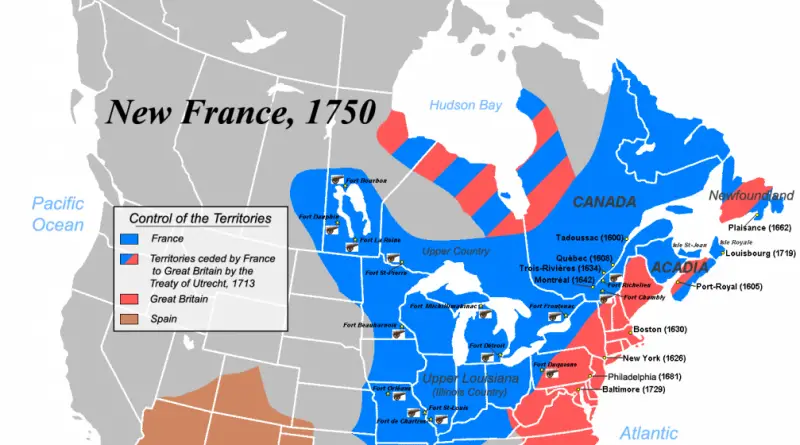
New France was the area colonized by France in North America during a period initiating with the exploration of the Gulf of Saint Lawrence by Jacques Cartier in 1534 and finishing with the cession of New France to Great Britain and Spain in 1763.
Read more: New France Mapped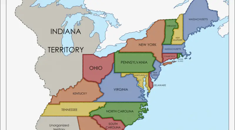
The Louisiana Purchase was the purchase of the territory of Louisiana by the U.S. from France in 1803. In return for 15 million dollars (~$18 per square mile), the U.S.obtained 828 thousand square miles or 2.14 million square kilometers. But, in reality, before purchase France only controlled a small part of this territory, mostly inhabited by Native Americans.
Read more: Louisiana purchase mappedIn less than a century, the United States transformed from a small coastal republic into a continental nation. Through the Louisiana Purchase, annexations, treaties, and wars, it gained territories stretching from the Atlantic to the Pacific by 1853.
Read more: Growth of United States (1776 – 1853)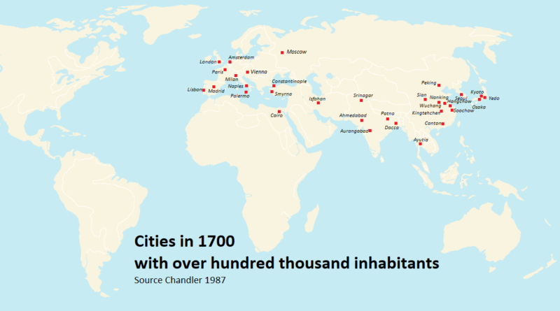
Where do 42 million people live together? The answer might surprise you. Today’s largest city isn’t where most people expect, and the journey from ancient Mesopotamia to modern megacities shows how empires, trade routes, and industrial revolutions reshaped where humans chose to live.
Read more: Largest Cities Throughout History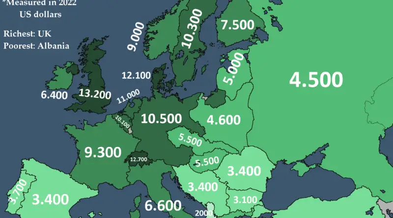
In 1938, the year before WW2, the United States had, by far, the largest economy worldwide in terms of GDP. The 5 Allied Great Powers that arose victorious from the war and the 3 Axis Tripartite Pact nations that were eventually defeated made up the 8 largest sovereign economies in 1938.
Read more: Economic Power Before World War II
Every Dutch town on a modern road sign is the latest draft of something considerably older, worn down by centuries of spoken language. This map by Victor van Werkhooven uses documented historical sources to show what the country would look like if that process had never started.
Read more: Ye Olde Netherlands: Dutch Town Names in Their Oldest Written Forms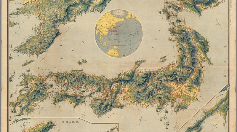
On the morning of November 3, 1921, Tokyo Asahi Shimbun readers found a large bird’s-eye map of the Japanese Empire folded inside their paper – Korea, Taiwan, Sakhalin, every railway in red, compiled by a former Army engineer. Nine days later, Japan’s delegates were in Washington D.C. for the Naval Conference that recognized Japan, for the first time, as one of five world powers.
Read more: Bird’s Eye View of Japan (1921)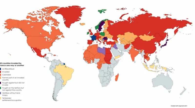
At its largest, France’s colonial holdings covered close to a quarter of the world’s land. Two overlapping empires, a world war that pulled them apart piece by piece, and the departments, territories, and ocean claim still left of it today.
Read more: All countries invaded by France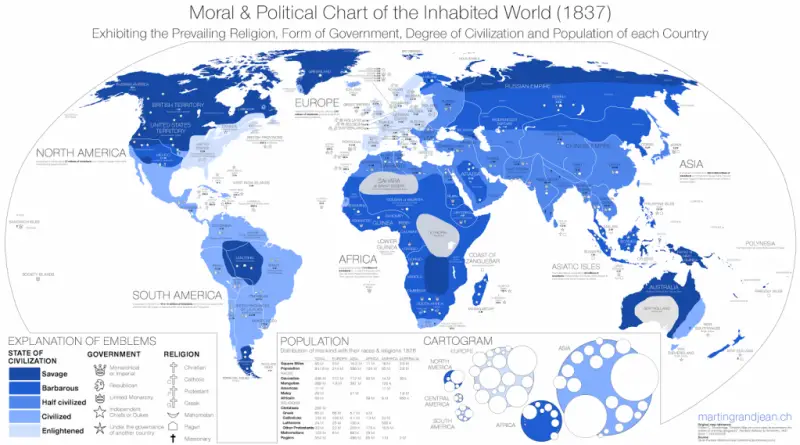
A Connecticut classroom atlas from 1837 sorted the entire world into five stages of civilization, from Savage to Enlightened.
Read more: Moral and Political Chart of the Inhabited World (1837)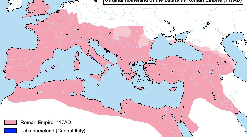
A small Italic tribe from Latium gave Rome its language. Here is how that tiny homeland compares to the empire Latin eventually spread across, and why the language split apart afterward.
Read more: Original Homeland of the Latins vs Roman Empire