Italy (1494)
Reddit user: AJgloe
Read more: Italy (1494)
Historical maps showing territorial changes of countries and historical events of the past.
Reddit user: AJgloe
Read more: Italy (1494)Reddit user: ThorPL123
Read more: The Anglo-Saxon Kingdoms, CA. 800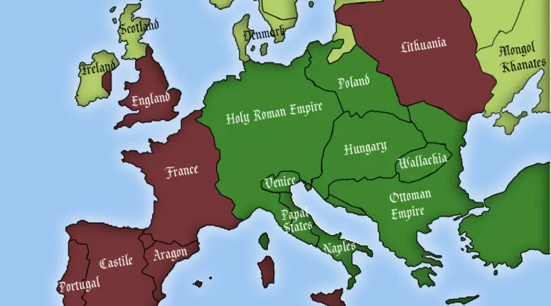
“The role that Christian dogmatism played should not be underestimated. Most of Europe was devoutly Christian right up until the
Read more: European countries where Jews were allowed to exist in 1500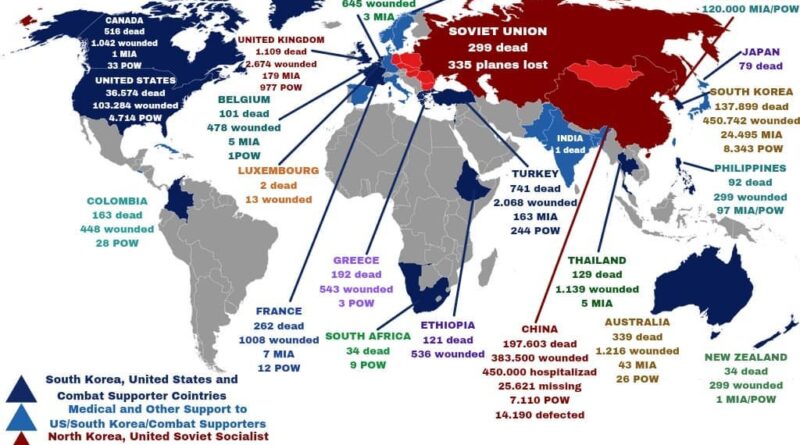
In 1945, Korea got split in half. Five years later, war broke out. Twenty-one countries sent soldiers. Close to 4 million people died. The fighting ended in 1953 but the war never did.
Read more: Korean War (1950 – 1953)This video maps out the entire history of the Middle East. Due to older dates being less certain, the speed
Read more: The History of the Middle East: Every Year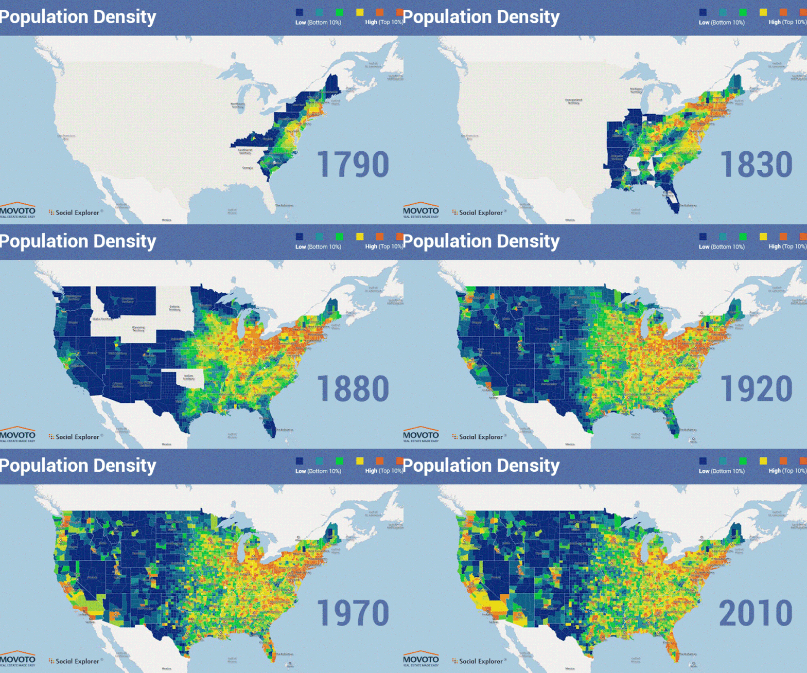
The U.S. is the 3rd largest country globally, but this country was not always like this. The 1803 Louisiana Purchase doubled the young American republic’s size, just 20 years after it got independence from Britain Empire. Then the country continued to grow in size.
Read more: The United States of America Territorial ExpansionA little late for Canada 150, but here is a map of Canada’s first ever election – held between August
Read more: A map of Canada’s first ever election (1867)Take a journey through the history of the Iberian Peninsula with animated maps that illustrate the rise and fall of states, empires, and cultures over the past 1000 years. Discover how ancient Iberia transformed into modern-day Spain and Portugal.
Read more: The History of Iberia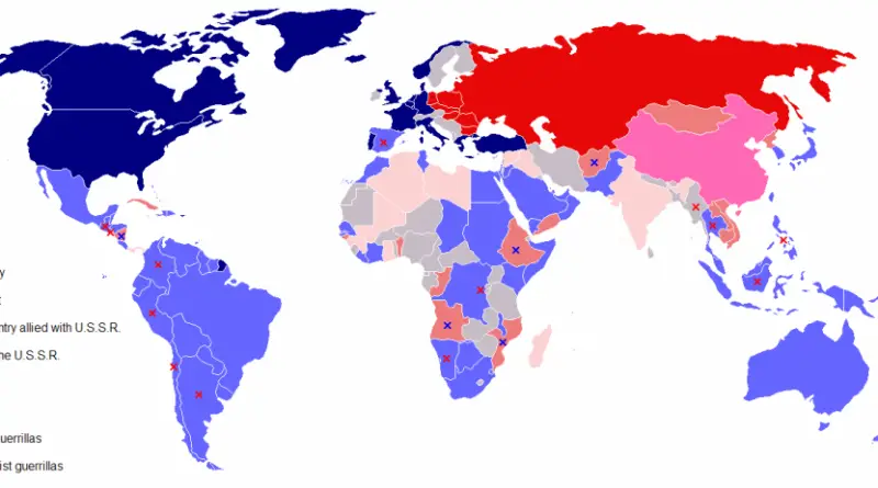
The Cold War was a geopolitical and ideological struggle that emerged in the aftermath of WWII, lasting roughly from the late 1940s to the early 1990s. It primarily pitted the United States and its Western allies against the Soviet Union and the Eastern Bloc, marked by intense political, economic, and military rivalry.
Read more: Map of the Cold War
Throughout the histories of the four countries of the UK, a variety of languages have been used to name places.
Read more: British Isles: Historic CountiesAround 700 BCE, the first Himalayan civilizations appeared. The Tibetan Empire would dominate the region during much of the Middle
Read more: The History of the Himalayas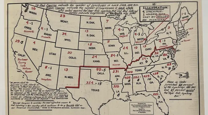
From 1883 to 1941, there were 4,467 sufferers of lynching. Of these, 4,027 were male, 99 female, and 341 were of unknown gender. Regarding ethnicity, 3,265 were black, 1,082 were white, 71 were Mexican or of Mexican origin, 38 were American Indian, 10 were Chinese, and 1 was Japanese.
Read more: Lynching in America Mapped