
Historical Maps
Historical maps showing territorial changes of countries and historical events of the past.
US News Map
US News Map allows users to search Chronicling America: Historic American Newspapers and visualize the results across space and time.
Read more: US News Map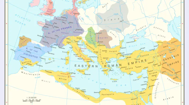
The Eastern Roman Empire
The death of Theodosius the Great in AD 395 marked the formal division of the Roman Empire, leaving east and
Read more: The Eastern Roman Empire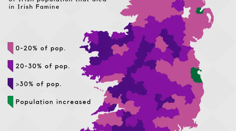
Irish Famine Mapped
Between 1841 and 2020, Mayo County’s population plummeted from 390,000 to 130,000—a staggering 67% decline. Meanwhile, Dublin exploded from 440,000 to 1.35 million. What caused such dramatically different paths for Irish counties after the famine? These population distribution maps reveal patterns that persist nearly 180 years later.
Read more: Irish Famine MappedGeography of Violence
Map of every war ever.
Read more: Geography of Violence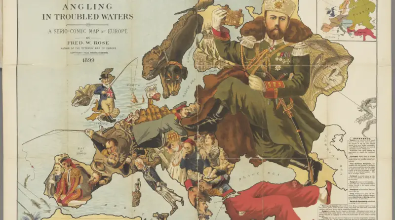
Atlas of satirical maps of Europe
was the location of powerful states that frequently competed with each other. They took part in bloody wars and weaved diplomatic intrigues behind the scenes. In this confrontation, satire was not only an art form but also a dangerous weapon, the purpose of which was to convey to its population and the population of other countries who’s who in the political arena.
Read more: Atlas of satirical maps of Europe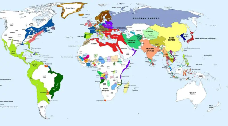
Political map of the World (1700)
The global population in 1700 was much smaller compared to today, estimated to be around 600 million people. The dominant powers in the world were primarily concentrated in Europe.
Read more: Political map of the World (1700)