
Historical Maps
Historical maps showing territorial changes of countries and historical events of the past.
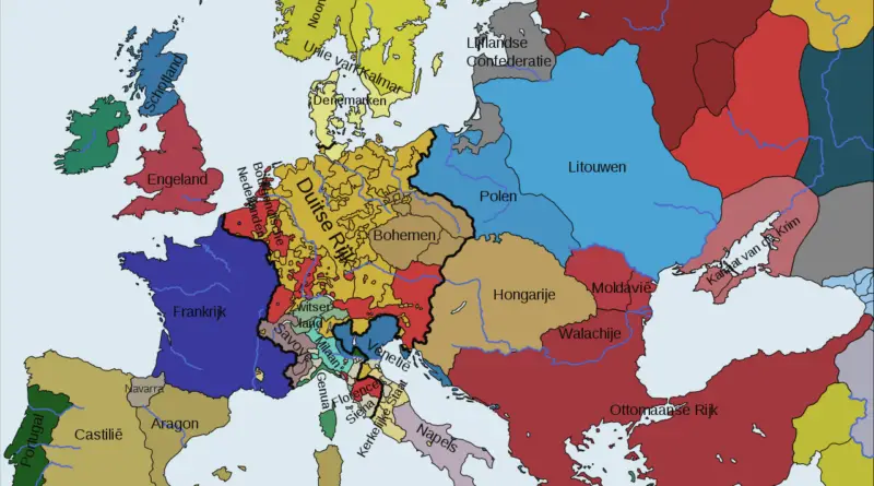
What Did Europe’s Map Look Like in the 1500s?
Journey through 16th-century Europe, where powerful city-states dominated Italy, the Habsburg dynasty built an empire, and the Ottoman Turks reshaped the continent’s eastern borders. Learn how this crucial period transformed Europe’s political landscape.
Read more: What Did Europe’s Map Look Like in the 1500s?20 thousand tons of TNT
These secret maps were used to explain to the members of the Congressional Joint Committee on Atomic Energy (JCAE) the
Read more: 20 thousand tons of TNTIsochronic distances in days from London (1881)
Relates posts:– Isochronic distances in days from London (1914)
Read more: Isochronic distances in days from London (1881)The Portuguese Empire at its maximum extent
The Portuguese Empire, also known as the Portuguese Overseas, was the 1st Global Empire in History, starting in 1415 with the conquest of Ceuta, over 500 years after Portugal’s foundation in 868. In addition, it was the longest-lived of the modern European colonial empires, spanning nearly six centuries, making it the most extended Global Empire in History.
Read more: The Portuguese Empire at its maximum extent