Interactive maps
Currently in the contiguous U.S. only Florida has no snow cover
Relates posts: – Daily US snow depth (1950 – 2015) – How much snow it typically takes to cancel school
Read MoreBuilding Heights in London
The map uses open LIDAR data.
Read MoreMapping snow removal in New York
Relates posts: – New York City greenhouse gas emissions – Energy use in NYC’s biggest buildings – Transit Time NYC – Mapping
Read MoreMaritime traffic density around North America
Via marinetraffic.com
Read MoreVanished aeroplanes
Vanished Aeroplanes is a CartoDB created map of aeroplanes which have gone missing around the World.
Read MoreSnowfall accumulation this winter
Via washingtonpost.com
Read More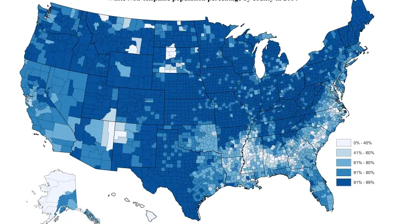
U.S. population by race
County resident population estimates by Race and Hispanic Origin (July 1, 2014). White Non-Hispanic population percentage by county Hispanic population
Read MoreEvery earthquake felt in Canada from 1985
While many on B.C.’s South Coast were jolted out of their beds on Dec. 29 by a magnitude 4.8 earthquake,
Read More