
Political maps
Political Maps show governmental and administrative borders of countries, provinces, states, and counties, the location of major cities, and other political units.
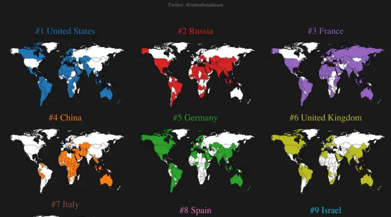
The world’s largest arms exporters
77% of arms exports were in the hands of just five nations: the United States, Russia, France, China, and Germany. While the five largest arms importers, India, Saudi Arabia, Egypt, Australia, and China, jointly received 38% of all imports of major arms.
Read more: The world’s largest arms exportersA world of difference
The world Gmi data, collected between 2008 and 2012, cover 117 countries and were prepared for Sctence by researchers Branko
Read more: A world of differenceFortressing Europe
A spate of construction & planned constructions of fences in Europe last decade hints at a new normal in illegal
Read more: Fortressing EuropeRegions of Europe
Europe is usually considered divided from Asia by the Ural Mountains, the Ural River, the Caspian Sea, the Caucasus Mountains, and the Black Sea. Europe covers about 2% of the planet’s surface. Politically, Europe is split into approximately 50 independent countries, of which Russia is the largest, spanning 39% of the continent. Moreover, Europe is frequently divided into regions based on geographical, ethnic, cultural, or historical criteria.
Read more: Regions of Europe