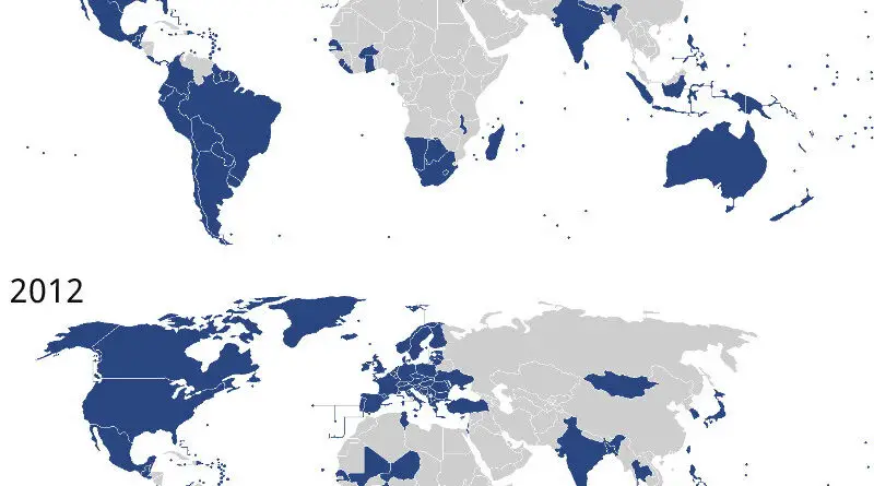
Political maps

Political Maps show governmental and administrative borders of countries, provinces, states, and counties, the location of major cities, and other political units.

Political maps

The Partition of Antarctica

Antarctica United States size comparison. Specialists from 30 nations live on about 70 bases, with a population of 4000 in summer. There have been 11 human births in Antarctica. The Antarctic Treaty (1961) banned any military activity and exploring for mineral resources. But in 2048, a treaty that bans all activities in Antarctica is set to expire.

Read More
Political maps

Flag Desecration by Nation

A flag is a piece of fabric with a specific design, format, and colors. One of the most popular purposes of a flag is to symbolize a country. National flags as patriotic symbols widely vary by interpretations that often include solid military associations because of their initial and ongoing use for that purpose.

Read More