Hamburg’s public transport live map
hvv.live
Read More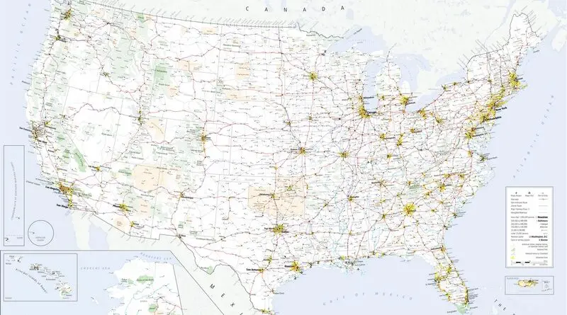
The U.S. boasts a vast and diverse transportation infrastructure that serves as the backbone of its economy and daily life. At the heart of this network is an extensive system of highways and roads, including the iconic Interstate Highway System, connecting cities and regions across the country. This highway network facilitates the movement of goods and people, supporting commerce, tourism, and daily commuting.
Read More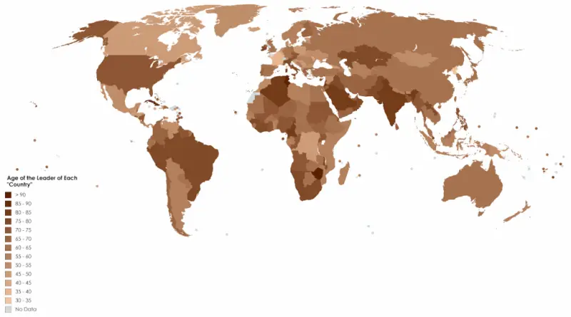
Beyond physical stature, various factors, including education, experience, skills, and personality, are pivotal for career advancement in politics. Nonetheless, it’s
Read MoreReddit user: XxX_datboi69_XxX
Read MoreData: github.com & cityofnewyork.us Via thegraphisdead.com Yellow NYC Cabs – yellow, Uber Cabs – green. Related post: – NYC cabs –
Read More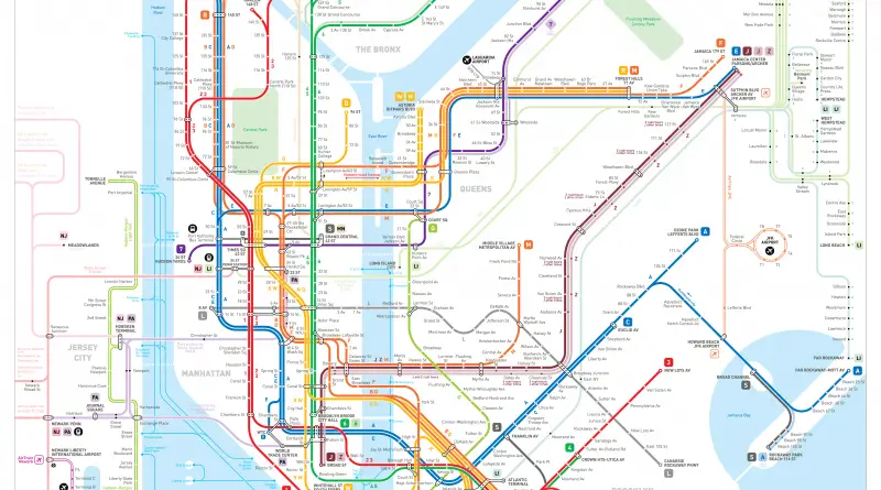
Jug Cerovic/INAT’s comprehensive map of the entire New York-Newark-Jersey City transit system, including subways, light rail, monorails, commuter rail, gondolas,
Read MoreLondon Reddit user: Pham_Trinli New York City Reddit user: playhouse_animation Washington Boston Atlanta Reddit user: D3signAllTheThings Toronto Source: mapto.ca Montreal
Read More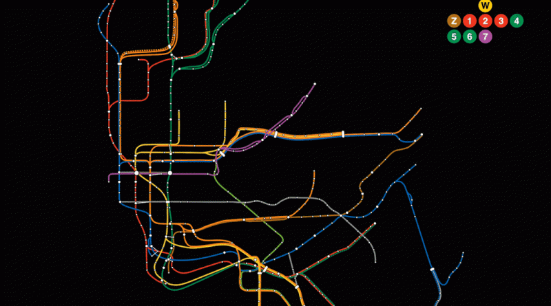
New York City’s subway map is a masterpiece of design, but how accurately does it represent the city’s true geography? Dive into the intriguing world of transit cartography and uncover the realities hidden beneath this iconic representation of urban navigation.
Read More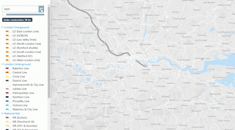
Source: citylines.co
Read MoreSource: bund.de
Read More