Describe Donald Trump in one word
What people think about Donald Trump in the world? 16,050 people think that Trump is an Arrogant 9,740 people think
Read MoreWhat people think about Donald Trump in the world? 16,050 people think that Trump is an Arrogant 9,740 people think
Read MoreAll countries have signed Paris agreement except the United States.
Read MoreVicissitudes of history and variations of (geography on the Indian subcontinent have created an intricately patterned cultural fabric, woven but
Read More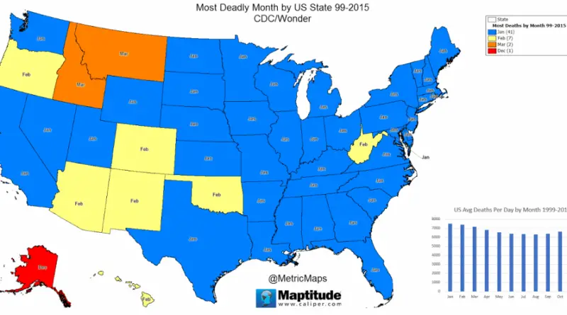
Source: metricmaps.org Winter is the most deadly season in the United States. January is the most deadly month in the
Read MoreEvangelical protestant population
Read More
Reddit user: donuboklumuharrem Most countries of Eastern Europe, with the exception of Russia, Latvia, Lithuania, and Estonia, are poorer than Turkey.
Read More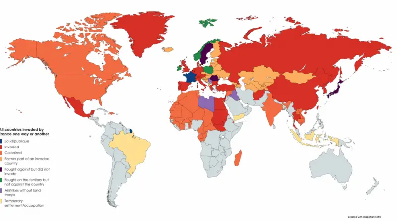
The First French colonial empire stretched from a total area at its peak in 1680 to over 10 million square kilometers (3.9 million sq mi). The Second French colonial empire stretched to over 13.5 million square kilometers (5.2 million sq mi) at its peak in 1936.
Read More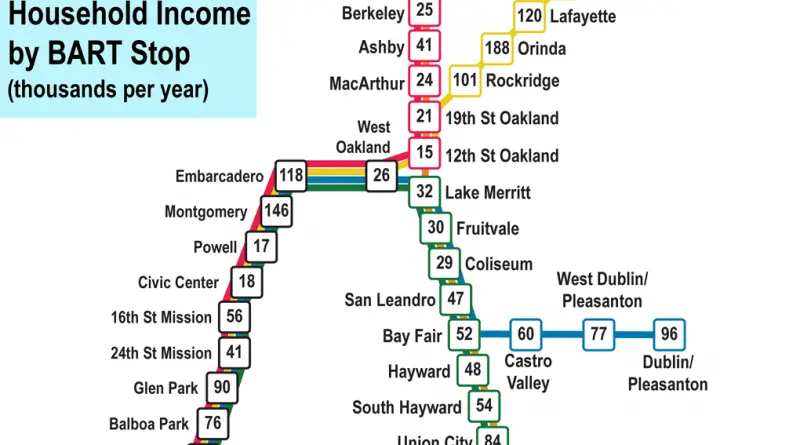
BART (Bay Area Rapid Transit), is a rapid transit public transportation system serving the San Francisco Bay Area in California.
Read More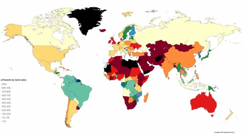
Reddit user: MagicGnomeS 20 countries with largest forest area (% of land area): #1 Suriname – 98.3%#2 Micronesia – 91.8%#3
Read More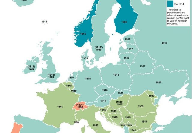
Starting in the mid-19th-century, women tried to alter voting legislation to permit them to vote. The first county in the world to award and maintain women’s suffrage continuously was Norway in 1913.
Read More