Percentage who agree with the statement “Success in life is determent by forces outside our control”
Reddit user: trinitronbx
Read More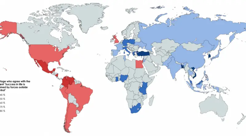
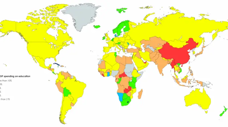
Reddit user: s251572
Read More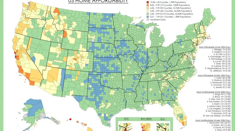
Housing affordability has become one of those topics everyone talks about but struggles to quantify. We hear about median prices rising, interest rates fluctuating, and markets “cooling” or “heating up.” But what does affordability actually look like when you map it county by county?
Read More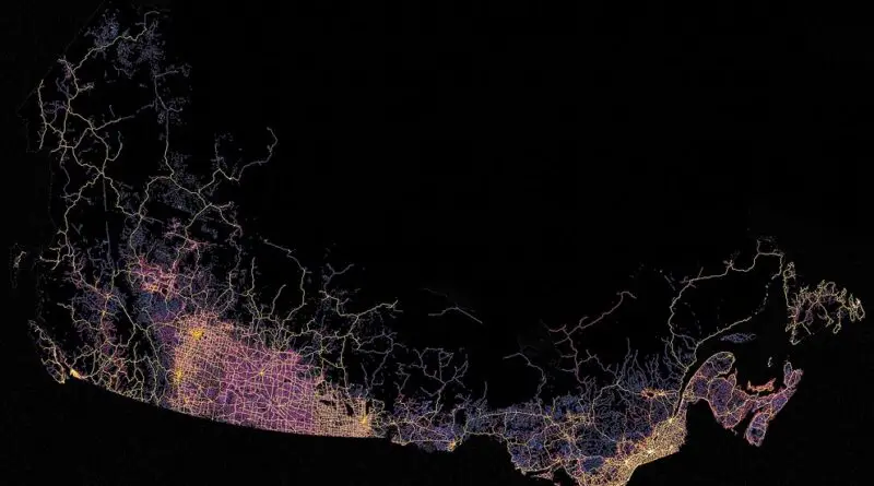
Canada is the second-largest country in the world. Therefore, it is not surprising that the total length of all roads in Canada is 1,042,300 kilometers (647,655 miles), of which 415,600 kilometers (258242 miles) are paved.
Read More– Despite being a party with usually very low voter share, the FDP (liberals) has participated in almost every German
Read More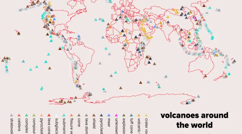
Volcanoes around the world classified by type and height.
Read MoreReddit user: sandyisback
Read More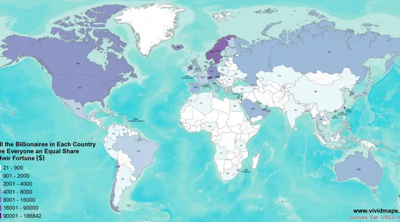
If All the Billionaires in Each Country Gave Everyone an Equal Share of their Fortune ($) If the Richest Billionaire
Read More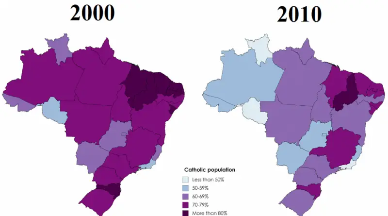
Brazil has the largest Catholic population in the world, but in the last decades, this predominance of Catholicism has been
Read More