Eye colour of European Heads of State
Reddit user: Juggertrout Blue seems to still be in the minority for the average European citizen, but it seems that
Read More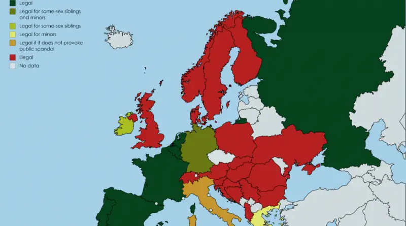
Legality of Consensual Sex between Siblings in Europe
Reddit user: trinitronbx
Read MoreContamination Risk in Houston
Facilities are often built for the “10-year” or 10% storm. Harvey has dropped a much larger amount of rain, comparable
Read MoreEuropean Ancestry Map
“ Reddit user: AJgloe Turks comes from the Central Asian steppes and are part of the Turkic language group, a language
Read More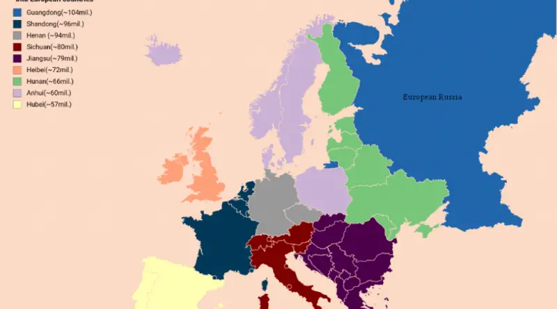
Largest Chinese provinces by population fitted into European countries
Larges Chinese administrative divisions by population fitted into European countries Reddit user: eivarXlithuania
Read More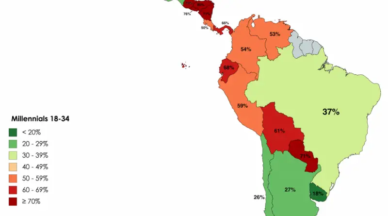
Percentage of Millennials in Latin America Who Say Gays &Lesbians Should Not Be Allowed to Marry Legally
Reddit user: nahuelacevedopena
Read MorePercentage of Millennials in Eastern Europe Who Say Homosexuality Should Not Be Accepted By Society
Source: lursh123 The highest percentage of opponents of same-sex relationships was registered in Armenia. “Homosexuality is seen as tantamount to
Read More
The Muslim population in 2050
Today Germany and France have the largest Muslim population in the European Union. Top 10 countries with the largest Muslim
Read More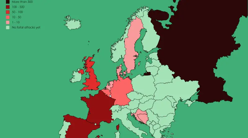
Fatalities caused by Islamist terrorist attacks in Europe
Deaths due to recognized terror attacks in Europe in 2017.
Read More