Skip to content
Vivid Maps Logo

  • Atlases
  • Map Posters
  • Scratch Maps
  • Globes
  • Videos
Crime mapsInteractive mapsMapping StereotypesVivid maps
June 7, 2017 Alex

Origin of Heroin in the U.S.

Reddit user: NelsonMinar Source: Jonathan Wain & Richard Jonson via National Post Related posts: – The stunning spread of the opioid painkiller

Read More
Economic mapsWorld
June 7, 2017 Alex

Regional Trade Blocs

Reddit user: alectprasad

Read More
Interactive mapsInternetMapping HealthMapping Stereotypes
June 6, 2017 Alex

Mapping Traffic Fatalities on America’s Roads

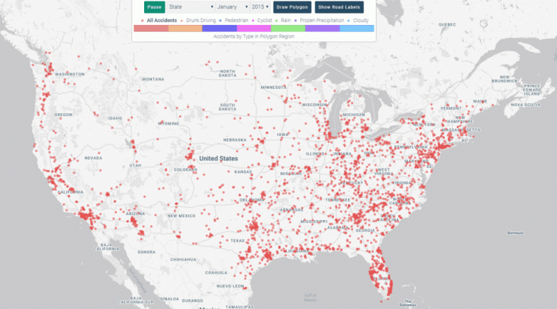
The number of traffic fatalities in the U.S. increased over 7% in 2015 relative to the previous year, the largest

Read More
Historical MapsMapping StereotypesWars
June 6, 2017 Alex

Map of Europe during World War I Respective Propaganda Posters

Reddit user: teerawk123 Related post: – A collection of satirical maps of Europe

Read More
Political mapsTransportVideoWorld
June 6, 2017 Alex

Age of the Leader of Each Country

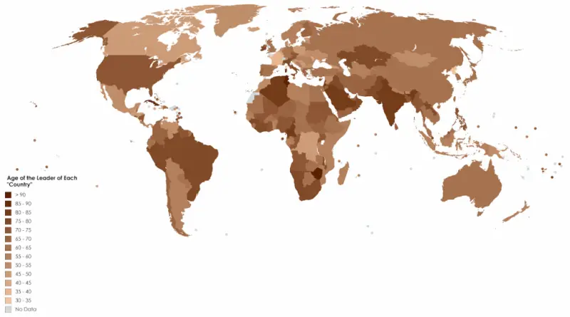
Beyond physical stature, various factors, including education, experience, skills, and personality, are pivotal for career advancement in politics. Nonetheless, it’s

Read More
Animated mapsEconomic mapsSliderVivid mapsWorld
June 5, 2017 Alex

Debt per adult by country (2000 – 2016)

Household debt levels from 2000 to 2016. Debt per adult by country (2000 – 2016) Youtube Debt per adult by

Read More
Languages
June 5, 2017 Alex

Languages of Scotland throughout history

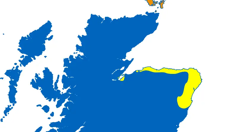
One of the biggest secrets in Scottish history is why the indigenous Picts have forgotten their language and culture and

Read More
CartogramsCitiesLawsMapping StereotypesPopulation
June 5, 2017 Alex

U.S. States scaled proportionally to population & density

US States scaled to the population. Density is marked by a thickness of edges. Reddit user: StarboardCapsized

Read More
Real estate
June 4, 2017 Alex

Monthly Rent Values Matched to Landing on Monopoly Hotel Values

U.S. Median Monthly Housing Costs Matched to Monopoly Hotel Values Source: metricmaps.org

Read More
Mapping Stereotypes
June 4, 2017 Alex

Languages of Scotland around the early 15th century, based on placename evidence

Reddit user: tescovaluechicken

Read More
Page 187 of 679« First«...102030...185186187188189...200210220...»Last »

Trending now

  • The largest territorial expanse of the Roman Empire
    The Roman Empire at its Territorial Height
  • The Price of Sex around the World Mapped

Related Products

Push pin maps · Globe drinks cabinets · Maps of the United States · Board games · Monopoly · Map-based strategy board games · History Board Games · Coloring Books · Handheld GPS · GPS Watches · GPS Trackers

Vivid Maps Tools

· Convert Latitude/Longitude
· Elevation Finder
· Distance Calculator
· Kilometers to Miles Converter
· Kilograms to Pounds Converter
· Liters to Gallons Converter
· Temperature Converter
· Antipodes Map
· Find cities with a similar climate
· Find cities with a similar climate (2050)
· How hot cities could be in 2050
· The U.S. Population Lines

About
Privacy Policy

Copyright © 2026 Vivid Maps. All rights reserved.