Purple America Has All But Disappeared
More than 61 percent of voters cast ballots in counties that gave either Clinton or Trump at least 60 percent
Read More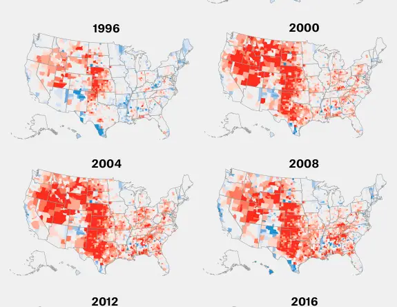
More than 61 percent of voters cast ballots in counties that gave either Clinton or Trump at least 60 percent
Read MoreSince Jan. 1, at least 100 locations of Jewish organizations in the U.S. – including schools, Jewish Community Centers, and
Read MoreA fuel is any material that can be made to react with other substances so that it releases chemical or
Read MoreSyphilis is a sexually transmitted infection provoked by the bacterium Treponema pallidum subspecies pallidum. But this infection may also be transmitted from mother to baby during pregnancy.
Read More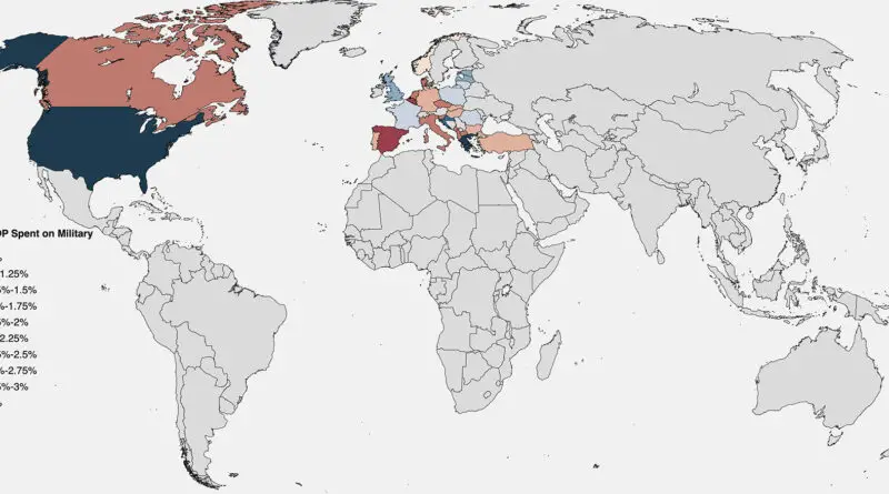
North Atlantic Treaty Organization was formed with 12 founding partners and has added new members 8 times, most recently when North Macedonia entered NATO in March 2020. After accepting their applications for participation in June 2022, Finland and Sweden are expected to become the 31st and 32nd military alliance members.
Read More
According to a study published in February 2017 in the Proceedings of the National Academy of Sciences, 84 percent of
Read More
We are living longer, but World Health Organization data suggest we are not all living healthier. Bad health years =
Read MoreGlobal health and travel security risks review. MEDICAL RISK RATING DEFINITIONSInternational SOS assigns medical risk ratings to countries* by assessing
Read More. Vegetation map by Griffith Taylor, 1929
Read MoreCalifornia exports its poor to Texas, other states, while wealthier people move in. About 2.5 million people living close to
Read More