The population density in Canada
Canada’s current population is about 38 million (2021). Meanwhile, the country’s population density is only 4 per square kilometers (11 people per square miles). The preponderance of Canada’s population is concentrated in the areas nearby to the Canada–U.S. boundary.
Read MoreHow India Eats (vegetarianism by state)
Vegetarianism is the practice of abstaining from the consumption of meat, and may also include abstention from by-products of animal
Read More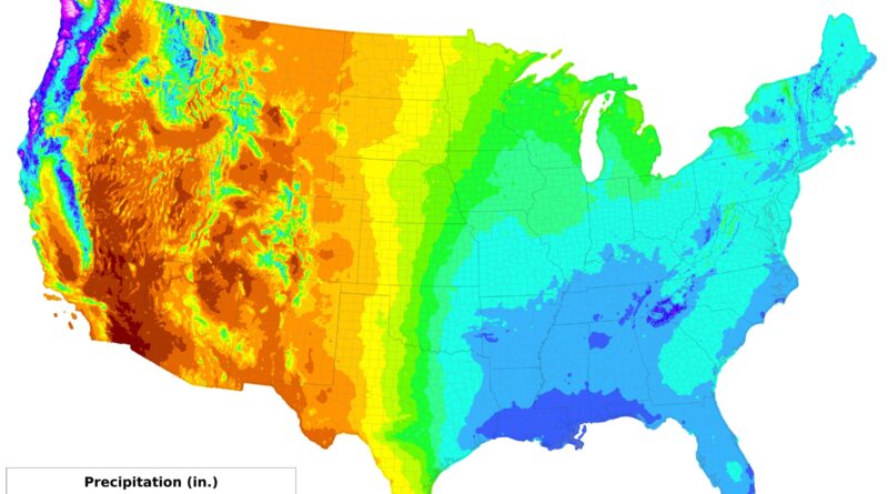
Precipitation Across America
Nevada receives 241 mm of rain annually while Hawaii gets 1,618 mm. Death Valley sees about 50 mm, Mount Waiʻaleʻale over 11,700 mm. The United States shows extreme precipitation contrasts shaped by mountains, coastlines, and seasonal patterns. Since 1901, precipitation has increased 4.6 mm per decade nationally, but the Southwest has become drier while northern and eastern regions receive more rainfall.
Read MorePopulation Change in the Greater Golden Horseshoe (2011 – 2016)
Population Change in the Toronto Region. Population density in the Toronto Region.
Read More
Detailed Map of the Catholic Dioceses and Baptized People in Europe
Detailed Map of the Catholic Dioceses in Europe Baptized People in Europe for Catholic Dioceses Reddit user: FrankCesco
Read More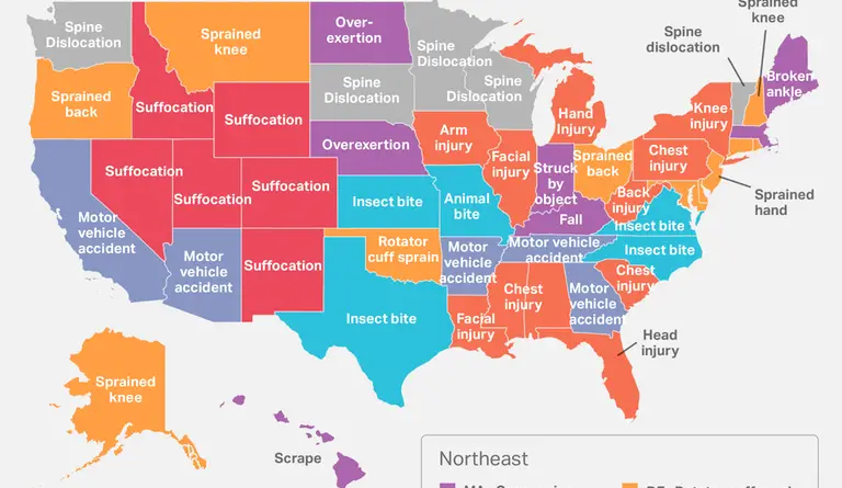
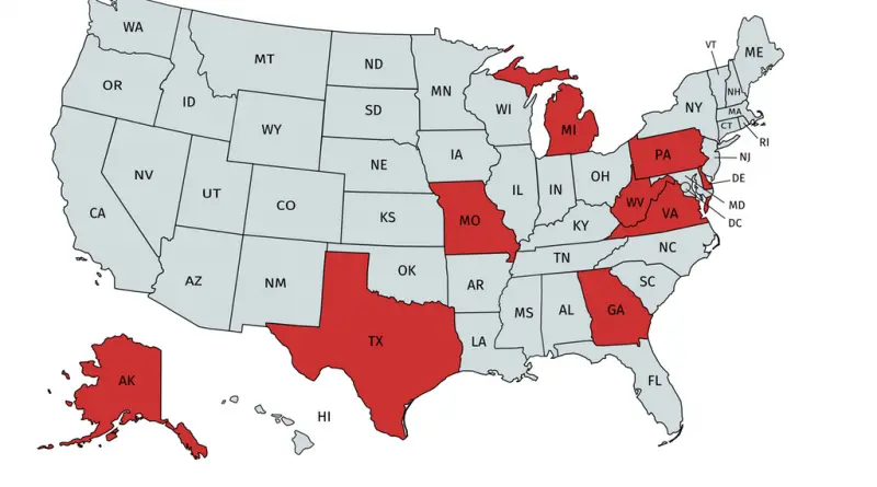
How Americans get hurt Themselves
Most disproportionately common physical injury diagnosis in each U.S. state, as documented in health insurance claims.
Read MoreThe World’s Most Valuable Brands 2017 by Country
The map shows the biggest brand in selected countries. Each brand shown is the biggest company of its country. Each
Read More