Car accidents in Birmingham
This visualization is showing 28519 car accidents that happened in the city of Birmingham during last years. This data are
Read MoreThis visualization is showing 28519 car accidents that happened in the city of Birmingham during last years. This data are
Read More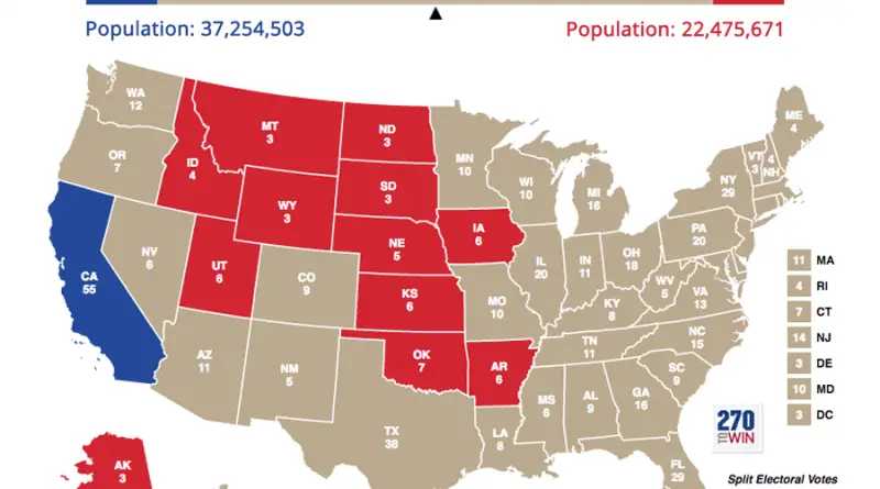
Related posts: – 3D map of county-level election results – Geographically approximate, population-normalized 2016 voting results using congressional districts –
Read More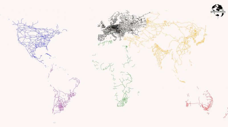
Modern rail transport began with the British development of the steam train when Richard Trevithick ran a steam train between Penydarren Ironworks and Abercynon in 1802. Thus the railroad system in Great Britain is the oldest in the world. In the 20th century, railroad transport reached maturity. Nowadays, the United States has the world’s most extended railway network, followed by China, Russia, and India.
Read MoreDymaxion map of world time zones departs from the traditional linear, West-to-East representation to propose a view of the world
Read More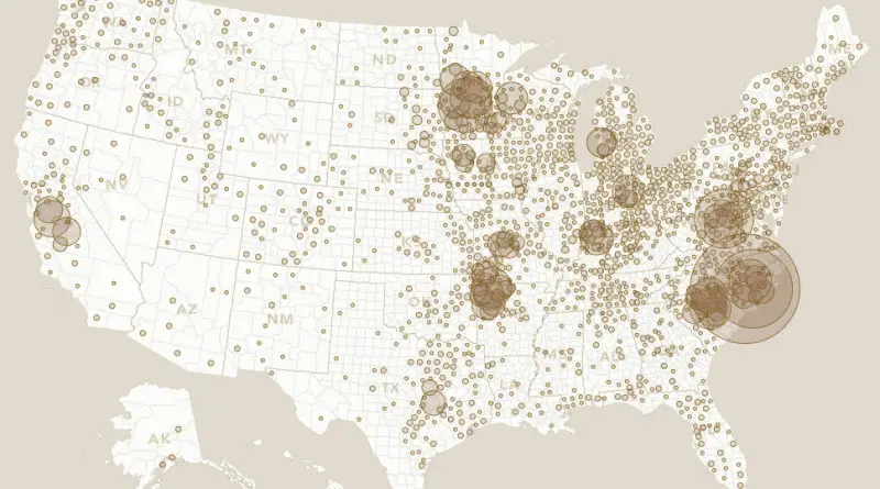
From the farm to your feast, take a look at where these four staples of the holiday meal may have originated
Read MoreCountries where people owe the most 1. Japan: $85,694.87 per person 2. Ireland: $67,147.59 per person 3. Singapore: $56,112.75 per
Read More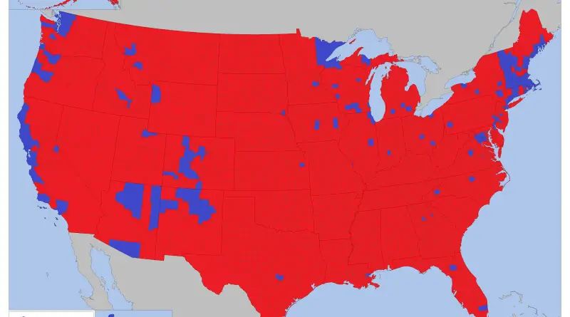
Via deviantart.net Related posts: – 3D map of county-level election results – Geographically approximate, population-normalized 2016 voting results using congressional
Read More