Songhua River
The main stem of the river and its myriad channels appear deep blue, winding from bottom left toward center right.
Read MoreThe main stem of the river and its myriad channels appear deep blue, winding from bottom left toward center right.
Read MoreMost expensive universities in the U.S. Least expensive universities in the U.S. Via www.howmuch.net
Read MoreWhere the 1% lives & how much they earn?
Read MoreA statistical projection of traffic fatalities for 2015 shows that an estimated 35,200 people died in motor vehicle traffic crashes. This represents
Read MoreThe foreign-born population in Rome.
Read MoreOil is the largest source of energy in the U.S., providing close to 40 percent of all of the nation’s
Read More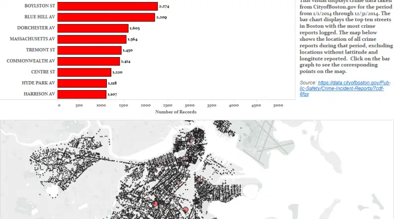
Visual analysis of the streets with the highest number of crime reports in Boston. Via datasee.org
Read More