
The United Watershed States of America
What if Powell’s proposal had succeeded? What if all American states were defined by watershed boundary? It might look like
Read more: The United Watershed States of AmericaMapping Australia: Housing affordability
The map shows the monetary gap (%) between the average earnings and the estimated minimum earnings required to purchase the
Read more: Mapping Australia: Housing affordability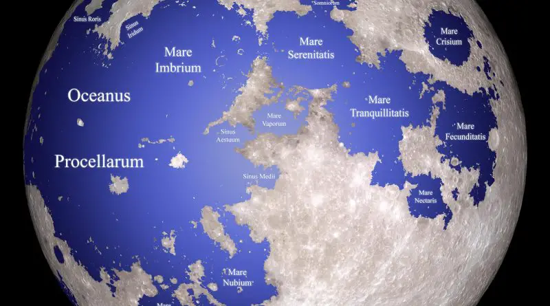
6 maps that explain the Moon
The Moon is the only natural satellite of our planet. It is the 5th-largest satellite and the 2nd-densest satellite after Jupiter’s satellite Io in the Solar System. From Earth, we only can see 15% of one side of the Moon’s surface because the Moon rotates around the Earth at the same speed as it rotates around its axis.
Read more: 6 maps that explain the MoonHeat Wave Days by US Contiguous County
Heatwaves in the United States are prolonged periods of excessively hot weather, often accompanied by high humidity. They can have serious impacts on human health, infrastructure, and ecosystems. Heatwaves are most common in the summer but can occur at any time of year.
Read more: Heat Wave Days by US Contiguous County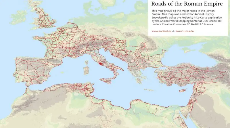
Roads of the Roman Empire
Roman roads used to move of officials, civilians, armies, and trade. Ways of the Empire were of different kinds, varying from small provincial roads to broad, long-distance roadways built to unite large cities, chief towns and military posts. These significant roads were surfaced with stone and metaled, cambered for drainage, and were flanked by walkways, bridle path and drainage trenches. They were set along ideally studied courses, and some were made through hills, canyons and rivers.
Read more: Roads of the Roman Empire