Potential Vulnerability to Climate Change
Over the next decades, it is predicted that billions of people, especially those in developing nations, face deficits of water
Read more: Potential Vulnerability to Climate Change

Over the next decades, it is predicted that billions of people, especially those in developing nations, face deficits of water
Read more: Potential Vulnerability to Climate ChangeEurope had the 2nd highest proportion of obese people, behind North and South America. Globally, in 2014, 39 percent of men and 40 percent of women aged 18 or over were overweight. Almost 1 adult in 6 in the European Union is considered overweight.
Read more: Obesity rates in Europe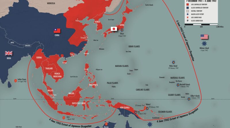
From the middle of the nineteenth century, Japan began to see a colonial empire on the Western-type as one of the traits of state power and political modernity.
Read more: Empire of Japan at its heightCountries with coastlines have jurisdiction over nearby waters, deciding to open some economic activity and to protect others from possibly
Read more: Layers of Ocean ProtectionCanada’s Arctic Strategy presented by the Canadian Defence and Foreign Affairs Institute. The Canadian Armed Forces’ return to the Arctic
Read more: Canada’s Arctic Strategy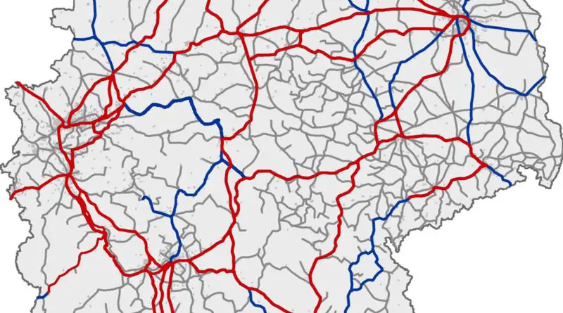
Germany has a railway network of 38 thousand kilometers of which 20 thousand kilometers electrified and 18,201 kilometers double track.
Read more: Railroad maps of Germany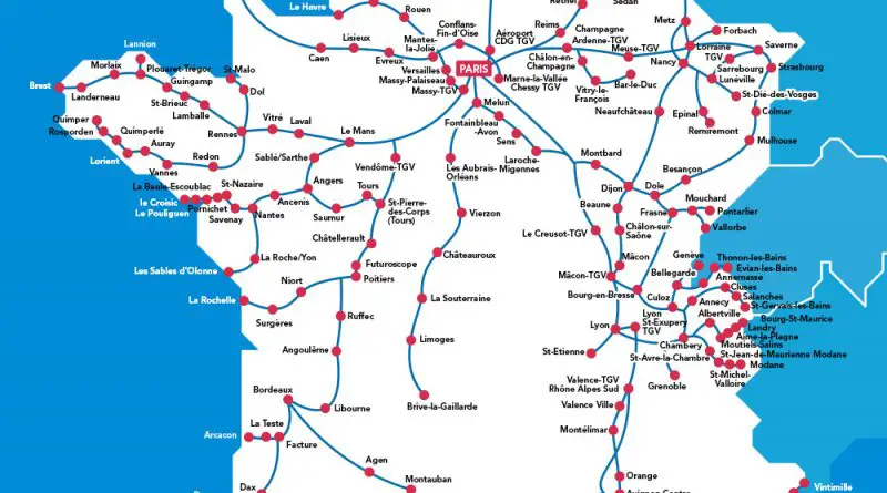
The first French high-speed railroad began to work in 1981. The LGV Sud-Est was the only high-speed railroad on the European continent. As of June 2021, the French high-speed rail network includes 2,800 kilometers.
Read more: How long it takes to travel from Paris by train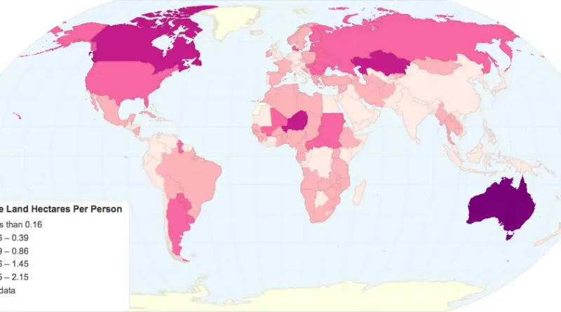
Arable land includes land defined by the Food and Agriculture Organization as land under temporary crops, pastures, land under market or kitchen gardens, and land temporarily unused.
Read more: Amount of arable land per personIncome inequality has been rising in many rich countries in recent decades. In the 1980s, the most prosperous 10 percent of the population in OECD countries earned seven times more than the poorest 10 percent. They now earn nearly ten times more.
Read more: Income distribution gaps in Europe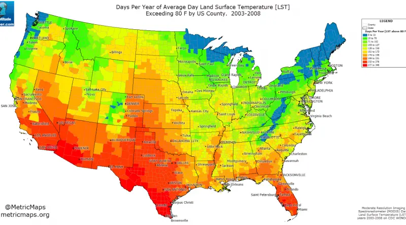
Days per year of the average day land surface temperature exceeding 80 Fahrenheit (27°C) by сounty. Texas and Arizona have
Read more: Days per Year of Average Day Land Surface Temperature Exceeding 80 F by US County (2003 – 2008)This map shows how long one would expect to travel to any point in Europe starting in London, using only
Read more: How long it takes to travel from London by trainBolivia covering approximately 1,098,581 (424,164 sq mi) and has population of around 12 million people. Population density: 10.4/km2 (26.9/sq mi).
Read more: Brazil Meets BoliviaA digital total sediment thickness database for the world’s oceans and marginal seas is being compiled by the National Geophysical
Read more: Total Sediment Thickness of the World’s Oceans & Marginal Seas