Where 300 Million People Celebrate New Year in March
Around 300 million people don’t celebrate New Year on January 1st—they wait for March 20 or 21 when spring begins.
Read More
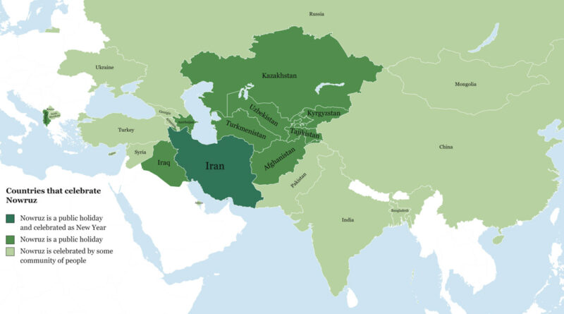
Around 300 million people don’t celebrate New Year on January 1st—they wait for March 20 or 21 when spring begins.
Read More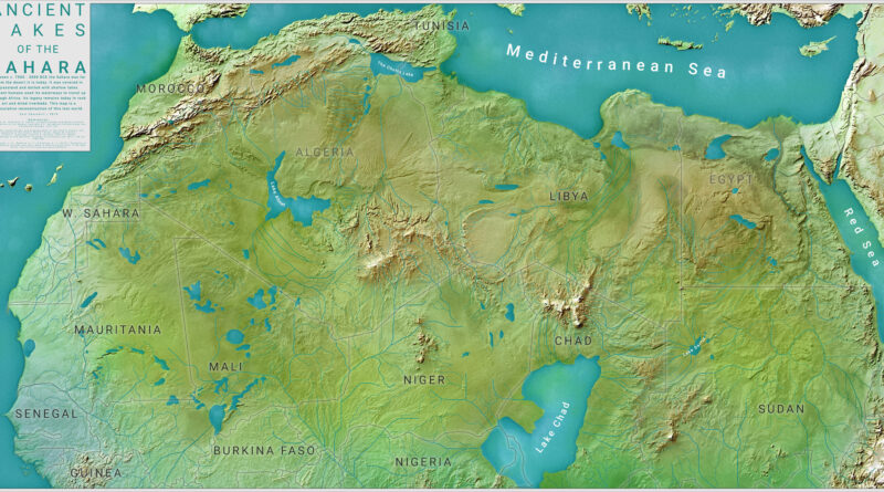
The Sahara wasn’t always sand and heat. Carl Churchill’s map reconstructs what North Africa looked like 8,000 years ago during the African Humid Period—a time when Lake Chad, Lake Darfur, Lake Ahmet, and The Chotts formed a network of waterways across grasslands. Ancient humans traveled these routes before climate shifts turned the region into desert.
Read More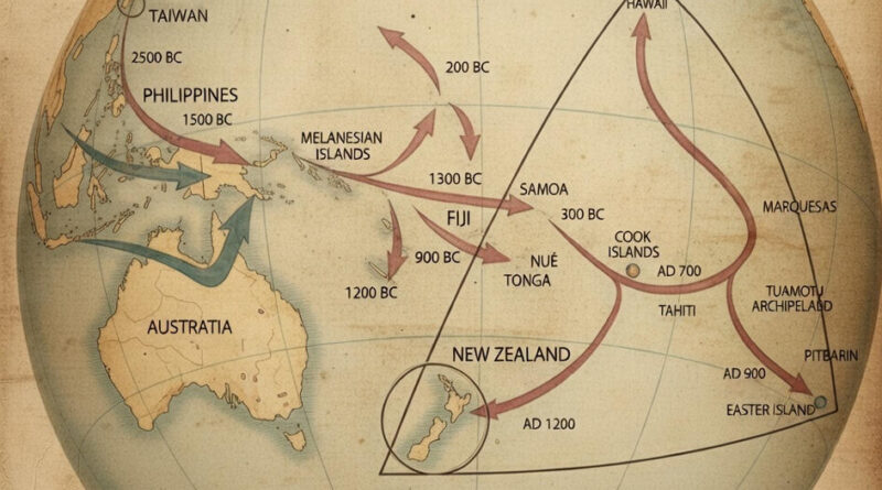
People who left Taiwan before 3000 BC eventually reached New Zealand by 1200 AD—a 4,000-year migration across scattered Pacific islands. This map traces the routes and dates of each leg of the journey, from the Philippines (2500 BC) through the Cook Islands (800 BC) to the final settlements in Hawaii, Easter Island, and New Zealand.
Read More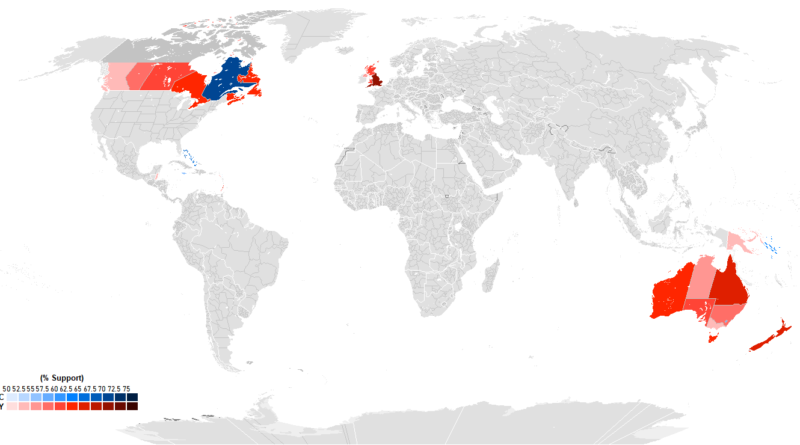
Recent polling from 15 Commonwealth realms shows huge differences in how people view having King Charles III as head of state. England leads at 76% monarchy support, with Tuvalu second at 73%. Quebec goes 70% for a republic, standing apart from other Canadian provinces. The Bahamas hits 65% republican sentiment, Jamaica 55%. Australia’s Capital Territory is the only part of that country preferring a republic at 59%. Caribbean nations cite colonial history as a major factor in their views.
Read More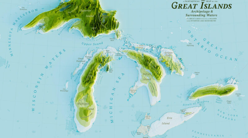
Five years ago, I made a stylized Great Islands map. Recently I found Stephen Kennedy’s version, and it got me thinking about what actually lives in these lakes. When you see them as islands, you remember they’re not just water—they’re ecosystems packed with life.
Read More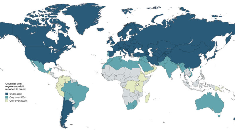
Snow in Kenya? Australia? South Africa? This elevation-based world map shows exactly where regular snowfall happens around the world.
Read More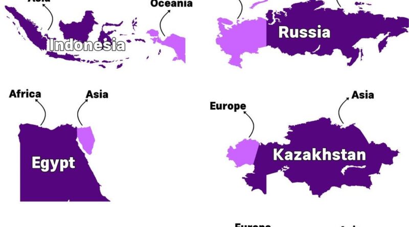
Russia is the obvious choice when thinking about countries that span two continents. But did you know Indonesia also qualifies? Or that Panama connects North and South America?
Read More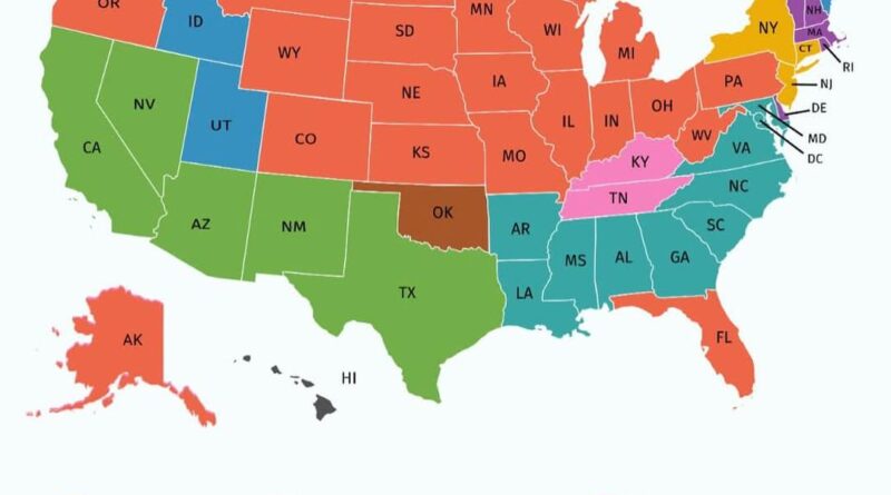
Germans dominate 21 states from Pennsylvania to Oregon. Forty-one million Americans identify as German, with Wisconsin at 36%. Mexicans lead five Southwest states at 11%. African Americans top nine Southern states where slavery was concentrated. Italians run New York, Connecticut, and New Jersey with 18 million Americans. Irish dominate New England at 11%.
Read More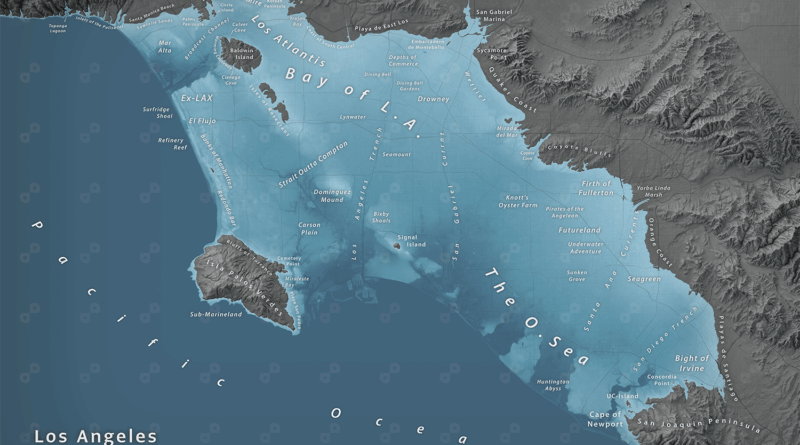
Jeffrey Linn mapped what Southern California looks like when 80 meters (260 ft) of seawater flood the LA Basin. Two versions show the transformation from basin to bay.
Read More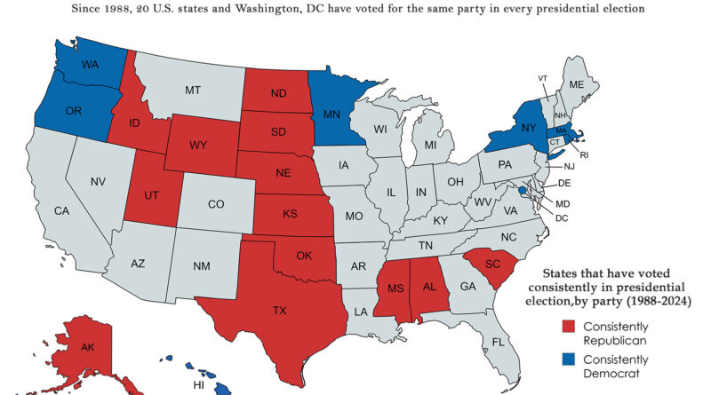
While swing states dominate election coverage, there’s another electoral geography worth examining. Twenty states and Washington, DC have remained remarkably consistent in their presidential voting patterns since 1988, creating a stable foundation beneath the shifting political landscape. Which states have never wavered, and what does their geographical distribution tell us about American political geography?
Read More