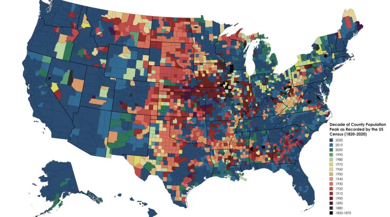
Historical Maps

European Colonial Shipping Lanes

British colonial shipping lanes covered vast expanses, connecting the British Isles to North America, the Caribbean, South Asia, and the Pacific. Spanish lanes were primarily transatlantic, centered on the Atlantic Ocean and Caribbean. French routes spanned the Atlantic, Indian, and Pacific Oceans, reaching North America, the Caribbean, Southeast Asia, and the South Pacific. Dutch shipping lanes had a global reach, including the Indian and Pacific Oceans, with a strong presence in Southeast Asia and the East Indies.

Read More
Environment maps

Autumn foliage colors mapped

Autumn foliage is a phenomenon that changes the green leaves of deciduous trees. By the end of October, yellow, orange, red, and brown varieties dominate, showing the coming of peak fall foliage in the western and northern U.S. When it comes to the end of November, all except the southern counties of the U.S. are past the peak point.

Read More