Australia
Australia plotted by every mapped stream and river… all 1.3 million of them!
Map created with QGIS using data for 1.3 million streams from Geoscience Australia GEODATA TOPO 250K vector datasets. Many arid-zone
Read More
Places in the World whose climates match with places in Australia
Relates posts: – USA Climate Comparison Maps – Places in the World that have similar climates to places in Canada
Read More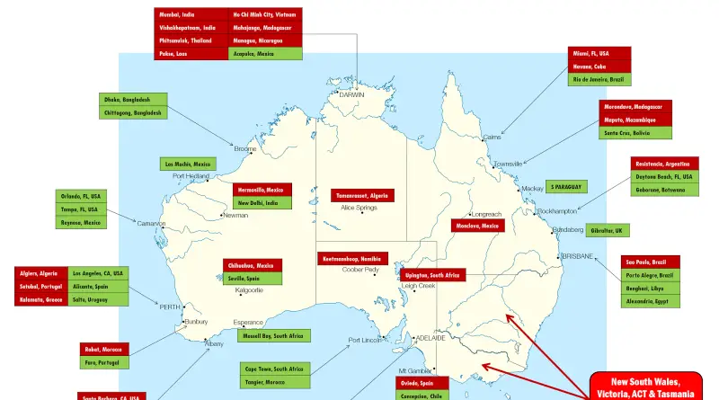
Places in the World whose climates match with places in Australia
Relates posts: – USA Climate Comparison Maps – Places in the World that have similar climates to places in Canada
Read MoreMelbourne building heights
Relates posts: – Vancouver building heights – The Toronto height map – Building heights in London
Read MoreThe Detailed Map of Australian Population Density
The Australian Bureau of Statistics has unveiled a groundbreaking map of population density, providing an unprecedented look at where people live across this vast continent. From the heavily populated coastal regions to the sparse interior Outback, this detailed visualization offers essential insights for understanding Australia’s unique human geography.
Read MoreMapping the Footprint of Australia’s First Nations
This innovative dot map provides an unparalleled look at the spatial distribution of Indigenous Australians, with one dot representing each of the nearly 700,000 individuals counted in the 2011 Census. By placing every person on the map, this visualization offers invaluable insights into the diversity and complex settlement patterns of Australia’s First Nations communities.
Read More