Canadian Wildfire Maps
Canadian Wildland Fire Information System.
Read More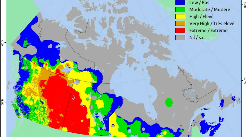
Canadian Wildland Fire Information System.
Read More3,510 sq km or 3,511,022 sq. mi), the vast majority of the nation is sparsely populated. Most of its population is south of the 55th parallel north, and just over 60% of Canadians reside in only two provinces, Ontario and Quebec.
Read MoreThis map is not a strict map of Vancouver but a new representation of Vancouver through its building height in
Read MoreItaly at night from the International Space Station by astronaut Tim Peake.
Read MoreTime lapse of fatal avalanches in Switzerland (1995 – 2016) The geographical distribution of fatal avalanches by the activity or
Read More
Other building age maps – Paris – Brooklyn – Los Angeles – Barcelona – Chicago – Chicago – Detroit –
Read More