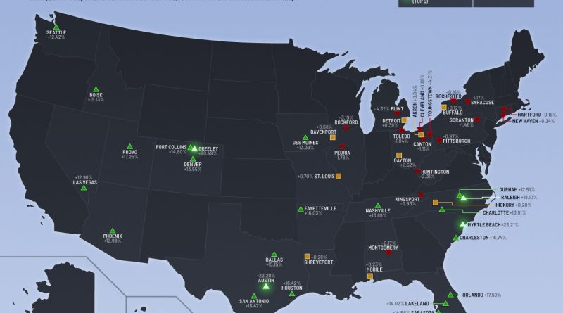
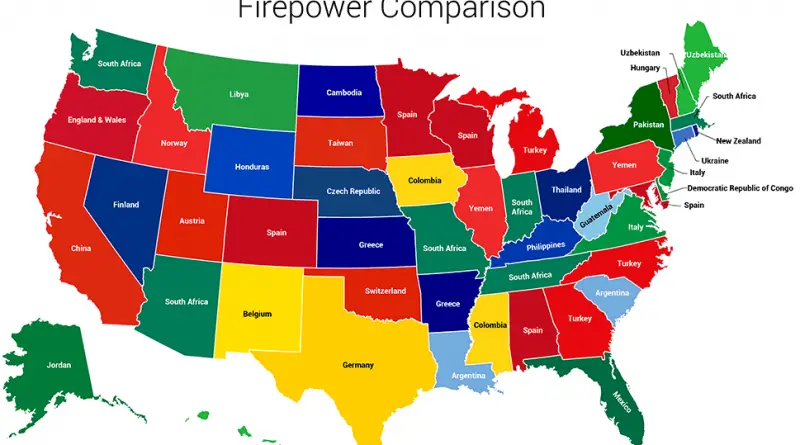
United States

Maps of the US

CitiesPopulation

The Population of Manhattan Mapped

In 1910, Manhattan crammed 2.3 million residents into 22 square miles—a density the borough has never matched since. By 2025, the overnight population sits around 1.7 million. But Manhattan’s real story isn’t about who lives here anymore. Every weekday, the island swells to nearly 4 million people by early afternoon, then empties out again each night. Midtown hits densities comparable to Mumbai and Macau at peak hours, while neighborhoods north of Central Park lose residents during work hours. Maybe the question isn’t how many people live in Manhattan—it’s how many people Manhattan holds at any given moment.

Read More
Economic mapsEnvironment maps

Climate Change and the U.S. Economy: A County-and-State Perspective

Climate change is projected to have vastly different economic impacts across U.S. states and counties, with coastal regions facing the heaviest financial burden. Florida and Texas each face potential GDP losses exceeding $100 billion, while states like Vermont and New Hampshire show minimal projected impacts. The analysis reveals that lower-income counties often bear a disproportionate burden of climate-related economic damage, highlighting the need for equitable adaptation policies.

Read More