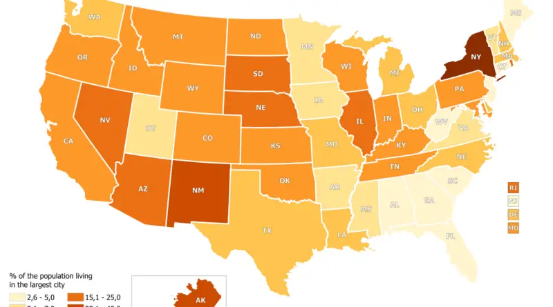
Comparing Metropolitan Form, Density & Transit Systems
Although many argue that cities around the world are moving towards automobile-dominant, low-density sprawl, a comparison of the Toronto region
Read MoreAlthough many argue that cities around the world are moving towards automobile-dominant, low-density sprawl, a comparison of the Toronto region
Read MoreIn most U.S. states, less than 20 percent of the population lives in the largest city. In South Carolina and West Virginia, even less than 3% of the population lives in the largest city. The highest percentage of the state’s population lives in New York City (New York) – 41.30% and Anchorage (Alaska) – 39.52%.
Read MoreSan Francisco Los Angeles New York City
Read MoreLondon Liverpool Edinburgh Glasgow Los Angeles New York City Washington Via gisforthought.com
Read MoreVancouver is divided into different zones which describe the details of permitted development, use, and so forth. If you’ve ever
Read More– Berlin: superimposed on Bern/Mittelland region (983 km2) – New York: superimposed on the Greater Zürich Area (2103 km2)
Read MoreDid you know from 1890 to 1958 the British Columbia Electric Railway Co. Ltd. installed and operated interurban and streetcar
Read MoreThis interactive demo displays the location of every bus and rail vehicle from TriMet in Portland, Oregon at any point
Read MoreRelated post: – World divided into regions with approximately the same population
Read More