Climate

ClimatePhysical maps

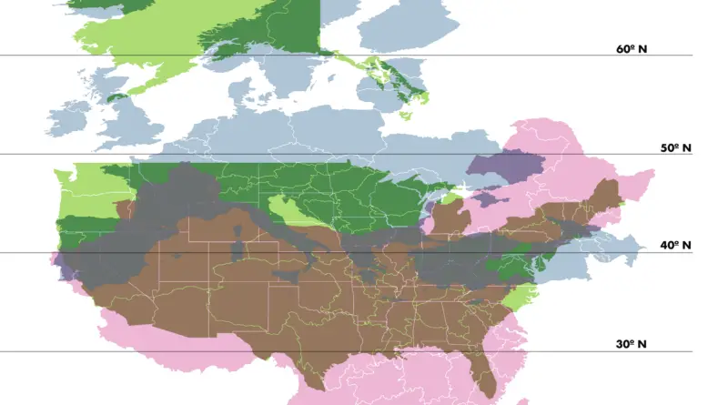
Comparing the Latitude of the United States with Europe and China

Understanding the latitudinal differences between China, the United States, and Europe provides valuable insights into the diverse climates and geographical features of these regions. From the tropical shores of China to the arctic landscapes of Alaska, the latitudinal range of these areas plays a crucial role in shaping their unique environments.

Read more: Comparing the Latitude of the United States with Europe and China
Climate

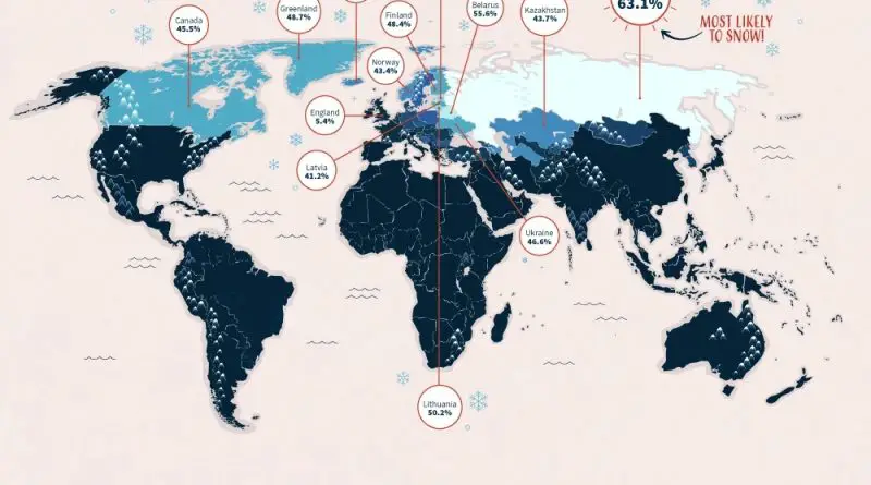
The ‘White Christmas Map’ Reveals Every Country’s Chance of Snow on Christmas Day – and Every State too…

New research based on the last 9 years of December snowfall Russia (63.1%), Belarus (55.6%), Estonia (50.9%), and Lithuania (50.2%) officially lead the way when it comes to the odds of seeing a White Christmas. Back in the US, Alaska (62.8%), Vermont (52.3%), and Minnesota (36.9%) top the list, leaving the others in the dust (Arizona, California, Florida, Hawaii, Texas).

Read more: The ‘White Christmas Map’ Reveals Every Country’s Chance of Snow on Christmas Day – and Every State too…
Climate

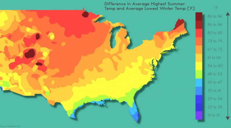
The Temperature Extremes That Define America’s Climate

Ever wonder why some U.S. regions experience massive temperature swings while others stay remarkably stable? A fascinating NOAA-based map reveals Colorado’s staggering 69°F (38°C) difference between summer highs and winter lows, while coastal areas like Southern Florida maintain gentle 20-30°F (11-17°C) variations. From Death Valley’s record-breaking 134°F (56.7°C) to Hawaii’s steady 15-20°F (8-11°C) range, discover what creates these dramatic climate differences and how they’re projected to intensify over the coming decades.

Read more: The Temperature Extremes That Define America’s Climate