Mapping Stereotypes
Animated marine traffic in the San Francisco Bay
How do big ships navigate the San Francisco Bay? The tracks on this map show telemetry data from 24 hours
Read More
Tearing the Netherlands apart
The Netherlands means “lower countries” about its low elevation and flat topography, with just approximately 50 percent of its land topping 1 meter (3 feet 3 inches) above sea level and almost 26 percent descending under sea level. The most culmination of the territories below sea level, known as polders, is land reclamation in the 14th century.
Read MoreRandom states of America
This interactive map creates randomly-generated state boundaries for the United States, and see who would recent presidential elections under the
Read More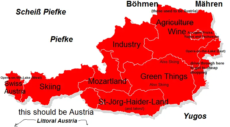
Austria stereotype maps
Austria is formed of nine federated states, Vienna, Austria’s capital and its most populous city. Seven of Austria’s 9 provinces have long historical traditions anteceding the Republic of Austria’s founding in 1918. The provinces of Burgenland and Vienna were organized after WWI. Most of Burgenland had been part of Hungary’s Kingdom, but it had a mainly German-speaking population and therefore became Austrian.
Read More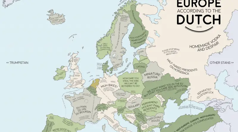
Europe according to the Dutch
The Dutch pioneered capitalism and influenced how the world thinks about free markets. But their view of Europe comes from more than economics. Distance feels different in a small country. Directness is normal. Everyone bikes everywhere. These stereotype maps capture how Dutch cultural traits shape perceptions of neighboring countries.
Read MoreYouth Development Index 2016 (2016)
Youth development can be achieved even in lowincome countries by providing quality education and training and allowing young people to
Read MoreOSM Landuse Landcover
OSM Landuse Landcover is a WebGIS application to explore the OpenStreetMap database specifically in terms of landuse and landcover information.
Read More