Old maps
The World according to Eratosthenes (BC 220)
Eratosthenes is the ancient Greek geographer and mathematician associated with eventing the first system of Longitude and Latitude. He was also the first know scientist to determine the circumference of our planet. It is a facsimile of the world map (around 220 BC) that Eratosthenes created based on his estimations.
Read More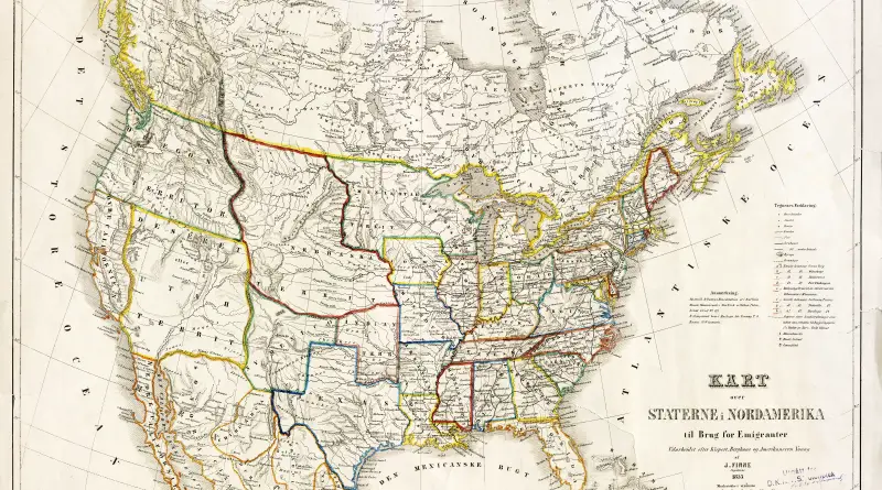
Historical Maps of the United States and North America
The exploration of North America by non-indigenous people passed over centuries and consisted of many people and voyages from different foreign countries to map this continent.
Read MoreGeological Map of England and Wales (1896)
The map was published under the direction of Sir Archibald Geikie.
Read More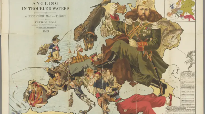
Atlas of satirical maps of Europe
was the location of powerful states that frequently competed with each other. They took part in bloody wars and weaved diplomatic intrigues behind the scenes. In this confrontation, satire was not only an art form but also a dangerous weapon, the purpose of which was to convey to its population and the population of other countries who’s who in the political arena.
Read MoreU.S. African American population, percent increase by county
Related posts: – U.S. population, percent increase by county – U.S. Hispanic population, percent increase by county – U.S. White
Read MorePartition of Germany
The situation in Germany after the Second World War was disastrous. Millions of Germans were homeless from Allied bombing operations that demolished entire cities. And millions more Germans living in Poland and East Prussia became exiles when the USSR exiled them. With the German economy and governance in shambles, the Allies decided that Germany must be occupied after the war to guarantee a peaceful transformation to a post-Nazi state.
Read More