
Old maps
Japanese Pictorial World Map, 1932
Japanese pictoral map, showing what were the national stereotypes at the time
Read more: Japanese Pictorial World Map, 1932A British Map of New York City (1776)
Related posts: – New Netherland settlements & areas of influence (1614 – 1674) – Urban Scratchoff – Interactive map of
Read more: A British Map of New York City (1776)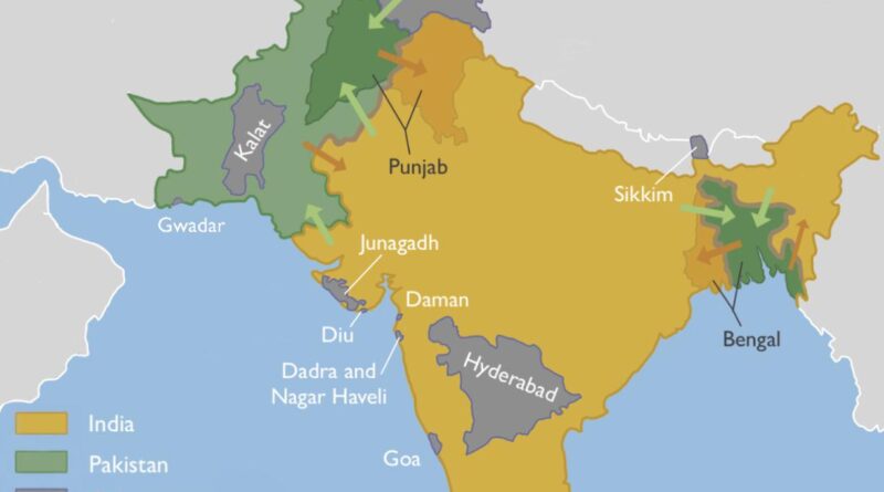
Partition of India Mapped
The Partition of India was the division of British India into two sovereign dominion nations, India and Pakistan. Nowadays, the Dominion of India is the Republic of India. The Dominion of Pakistan is today the Islamic Republic of Pakistan and the People’s Republic of Bangladesh. The partition involved two provinces, Bengal and Punjab, based on district-wide non-Muslim or Muslim majorities.
Read more: Partition of India MappedWorld map by Ferrando Bertelli (1565)
Ferrando Bertelli was born in Venice in 1525. He was one of the most creative of Venetian map maker and engravers of the Renaissance period, who also traded atlases and worked at different periods with other famous names in Venetian cartography.
Read more: World map by Ferrando Bertelli (1565)The Spread of Chess
Century in wich the game entered each country is indicated by date, A.D. Native names for chess are given for
Read more: The Spread of Chess“Underground” routes to Canada (1896)
Map showing the lines of travel of fugitive slaves in 1896.
Read more: “Underground” routes to Canada (1896)