Map of Oceania
Oceania is a geographical region that encompasses numerous islands and countries located in the central and western Pacific Ocean. It is known for its vast expanse of ocean and diverse cultures.
Read MorePolitical Maps show governmental and administrative borders of countries, provinces, states, and counties, the location of major cities, and other political units.
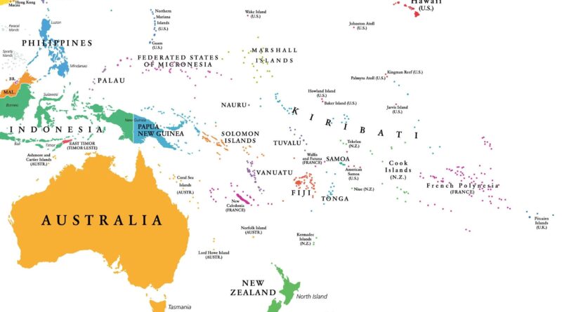
Oceania is a geographical region that encompasses numerous islands and countries located in the central and western Pacific Ocean. It is known for its vast expanse of ocean and diverse cultures.
Read More
The U.S. military budget of the U.S. is the highest in the world and amounts to about 700 billion American dollars. It accounted for 36% of the world’s defense expenses. There are more than 1.3 million active-duty militaries and over 800 thousand reserves.
Read More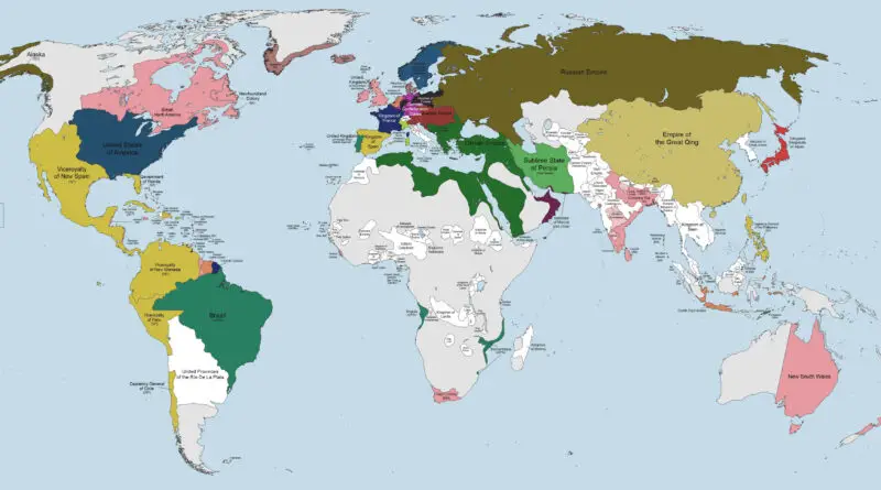
Although the world’s population only just reached 1 billion in 1804, on the world’s political map, one can find many countries whose borders differ little from those of modern nations.
Read More
The border between Europe and Asia is exceptional among continental boundaries because there is no significant physical distinction between the two continents except rivers and mountains east and north of the Black Sea. This boundary has been altered many times throughout history.
Read More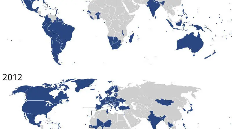
Overall the level of Democracy utilized by the average global habitant in 2022 is down to 1989 levels. The last 30 years of democratic advancements are now stopped. Liberal democracies peaked in 2012 with 42 nations and are now down to the most down levels in over 25 years – 34 countries.
Read More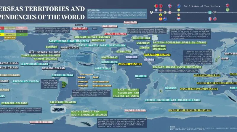
Overseas territory is a geographical area part of a country, but outside of its mainland or contiguous territory. In most cases, these regions are not recognized as autonomous nations, but instead, they are under another country’s or state’s governance.
Read More
To the question, “if there are parts of neighboring countries that really belong to us,” 67% of Hungarians responded affirmatively. Greece (60%), Turkey (58%), Bulgaria (58%), and Russia (53%) also had a high agreement.
Read More
In 2014, Russia occupied Crimea, and in 2022 Russia has undertaken devastating aggression on Ukraine by air, land, and sea. Why is Russia invading Ukraine?
Read More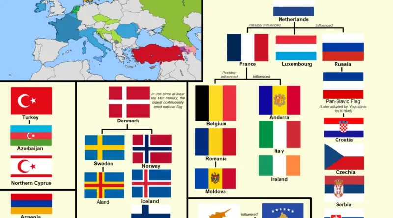
In Europe, there exist several instances of related flags, where certain countries share similar patterns, colors, or symbols in their national flags. These similarities often reflect historical, cultural, or geopolitical connections between nations.
Read More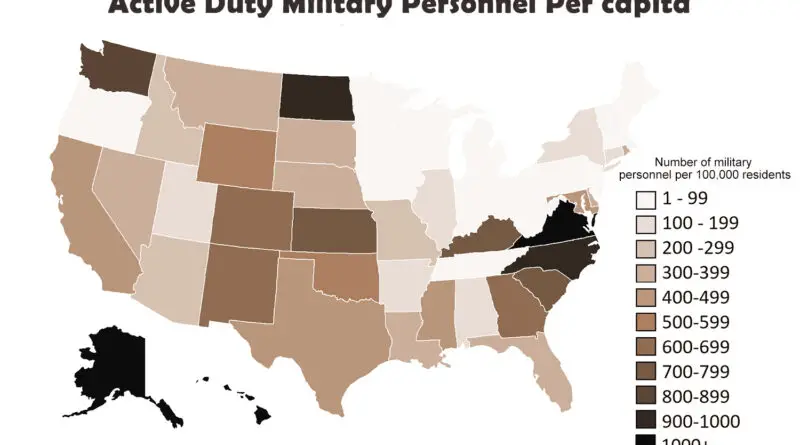
There were 1.195 million active-duty militaries and over 778 thousand reserve forces. Total active-duty members for the five armed services were 426,624 for the Army, 306,272 for the Navy, 147,846 for the Marine Corps, 275,298 for the Air Force Force, and 39,029 for the Coast Guard.
Read More