


Dialects of Austria
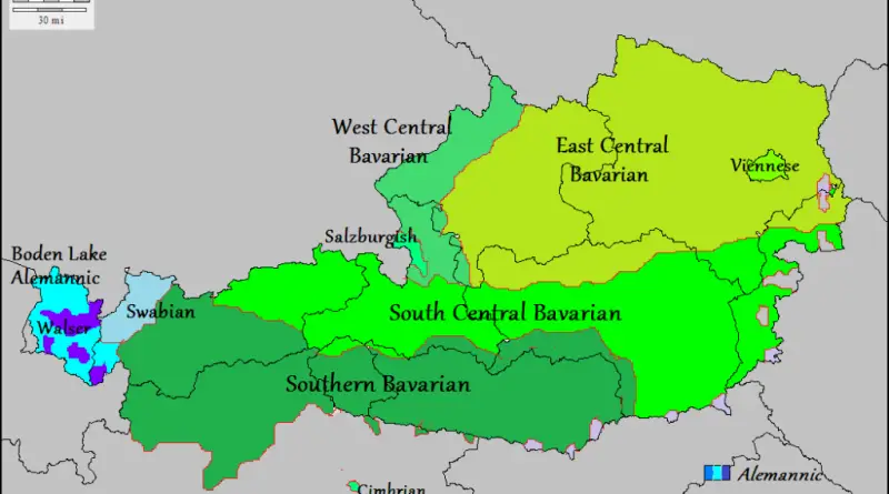
Bavarian dialects of Austria: East Central Bavarian, West Central Bavarian, South Central Bavarian, Southern Bavarian, Viennese, Salzburgish, Mocheno, Cimbrian Alemannic
Read More


Bavarian dialects of Austria: East Central Bavarian, West Central Bavarian, South Central Bavarian, Southern Bavarian, Viennese, Salzburgish, Mocheno, Cimbrian Alemannic
Read More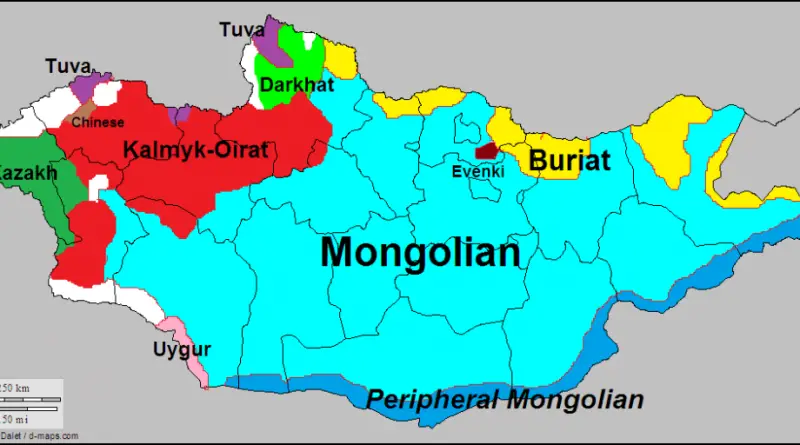
Mongolia, with a population of over 3 million, has 10 living languages (Mongolian, Peripheral Mongolian, Kazakh, Kalmyk-Oirat, Chinese, Uygur, Tuva,
Read More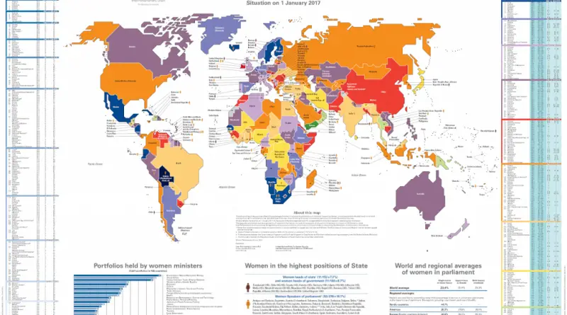
The color coding of the countries reflects the percentage of women in unicameral parliaments or in the lower house of
Read MoreIf phonological shifts and other language changes never happened and the first written instance of every town name was still
Read More
Nations from Germany can travel to 150 countries without Visa or with visa on arrival. 149 countries Americans can travel
Read More
At the time of European settlement in North America, primary or virgin forests covered nearly all of the East Coast (1 billion acres or 4 million sq. km.). By the end of the 20th century, virgin forests remained in the South. Nowadays, If we consider all forests, 37% of the United States territory (about 1/3 of the U.S.) is forested.
Read More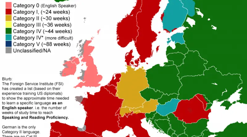
The time it takes to learn a language depends on many factors: How close the new language is to your native language or other languages you know; How complex the language is; How many hours each week you devote to learning the language; The language learning resources available to you; Your motivation.
Read More
Picture driving through ancient Silk Road towns, past snow-capped Himalayan peaks, and along tropical coastlines – all on one continuous route. Three national highways form a remarkable 27,000-kilometer circuit around China, offering an unmatched way to experience this vast country’s dramatic landscapes.
Read More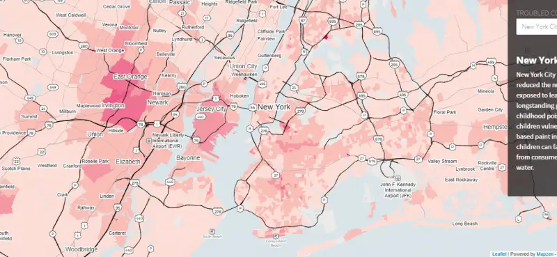
New York City has dramatically reduced the number of children exposed to lead but hasn’t met its longstanding goal of
Read More
This London housing density map has been created using 2015 LSOA housing data. The data records the number of homes
Read More