Violent crime in the United States 1990 vs 2015
Reddit user: CrewCamel
Read More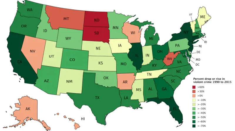
Reddit user: CrewCamel
Read MoreSource: dancarlin.com
Read MoreSource: nahuelacevedopena
Read MorePeoples of Yugoslavia.
Read More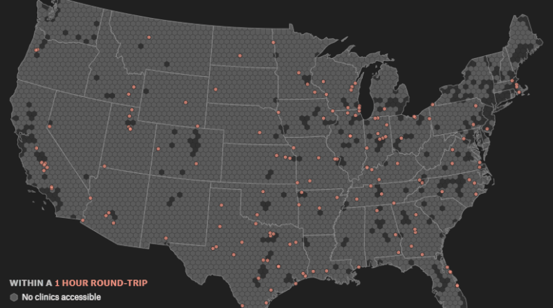
Urban areas in the United States with no accessible abortion clinics within a [X] hours round-trip drive Round-trip time to
Read More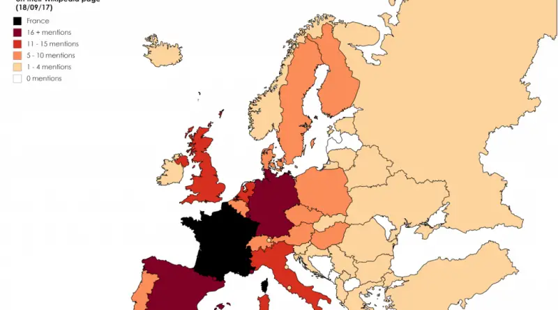
Reddit user: Flimajam Reddit user: – Countries of Europe by the number of mentions of “Germany” on their Wikipedia page
Read More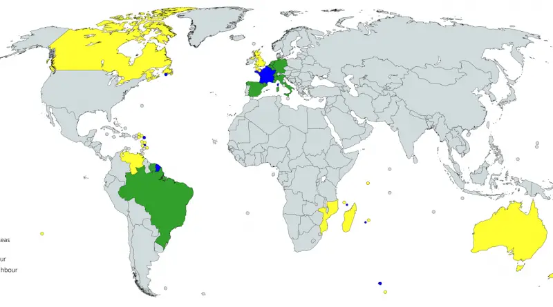
Reddit user: Tvashtar_Paterae
Read More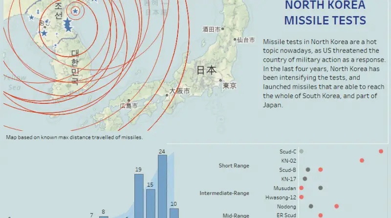
Missile tests in North Korea are a hot topic nowadays, as the U.S. threatened the country of military action as
Read MoreSource: usgs.gov Related posts: – Hurricane Irma Photo Map – Harvey, Katia, and Irma sure did churn up and heat from the
Read More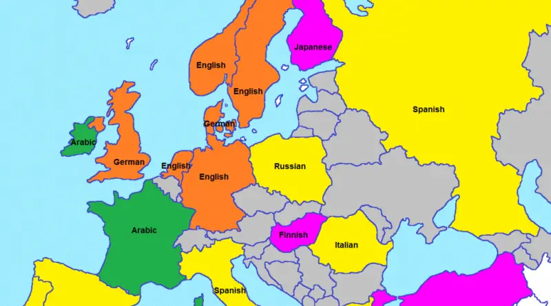
What the European languages sound like. Reddit user: vb4m
Read More