Degree of hemeroby (naturalness) of the overall landscape in the European Union (1996 – 2005)
Degree of naturalness of rural-agrarian landscape Via AJgloe
Read MoreDegree of naturalness of rural-agrarian landscape Via AJgloe
Read More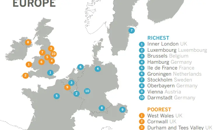
In 2017, according to Eurostat data, nine of the United Kingdom’s NUTS level 2 regions were in the bottom ten according to Gross Domestic Product per person when analyzing against nearby nations.
Read MoreLis Watkins
Read More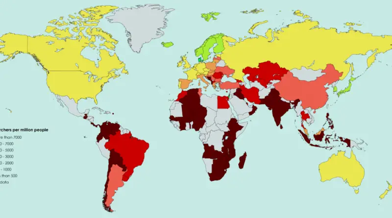
Reddit user: trinitronbx, Data: worldbank Countries with the largest number of scientists (per million): Israel – 8,255 Denmark – 7,484
Read More
Reddit user: CrewCamel
Read MoreSource: dancarlin.com
Read MoreSource: nahuelacevedopena
Read MorePeoples of Yugoslavia.
Read More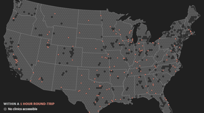
Urban areas in the United States with no accessible abortion clinics within a [X] hours round-trip drive Round-trip time to
Read More