GDP growth by country (2016)
Reddit user: MIA-in-MIA
Read More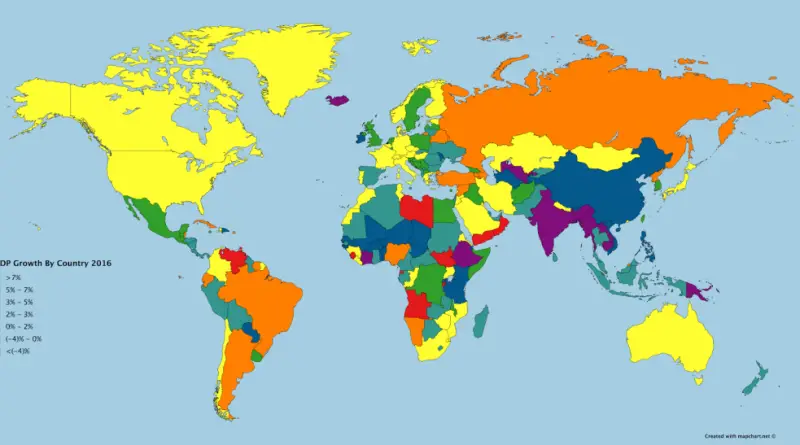
Reddit user: MIA-in-MIA
Read MoreTop 20 the most oldest U.S. companies Caswell-Massey – a perfume and soap company in Newport, Rhode Island (1752) The
Read More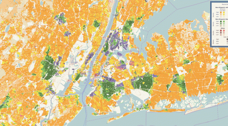
New York City Los Angeles San Francisco Chicago Source: sil.uc.edu
Read More
Sasha Trubetskoy
Read MoreThe cheapest power plant to build today in every U.S. county, including availability zones The second minimum cost technology for
Read MoreA biome is a community of plants and animals living together in a particular climate. There are 14 terrestrial biomes. Seven are forested, and 7 are not forested.
Read More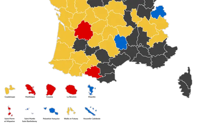
French election results by departments including overseas Reddit user: DoctorWinstonOBoogie French election result by city Reddit user: matdmr The French
Read More
World countries Population Fitted into the United States Population density of the U.S. named for similarly dense countries in Europe
Read MoreThe map is part of a broader effort to establish a hazards monitoring system that combines satellite observations of rainfall
Read More