Rise & Fall of the Ottoman Empire
The Ottoman Empire, one of the most significant empires in history, had a long and complex rise and fall that spanned over six centuries.
Read More
Mapping the Spread of Islam Across the World: A Historical Journey
Discover the fascinating journey of Islam’s spread across the globe with our comprehensive world map. Understand the historical conquests, cultural integrations, and theological divisions that shaped the Islamic world.
Read MoreGermany mapped only by roads
Reddit user: gosnox
Read MoreCoast Lines
The total length of coastlines in the world as 1.16 million kilometres. Benjamin Hennig via geographical.co.uk
Read More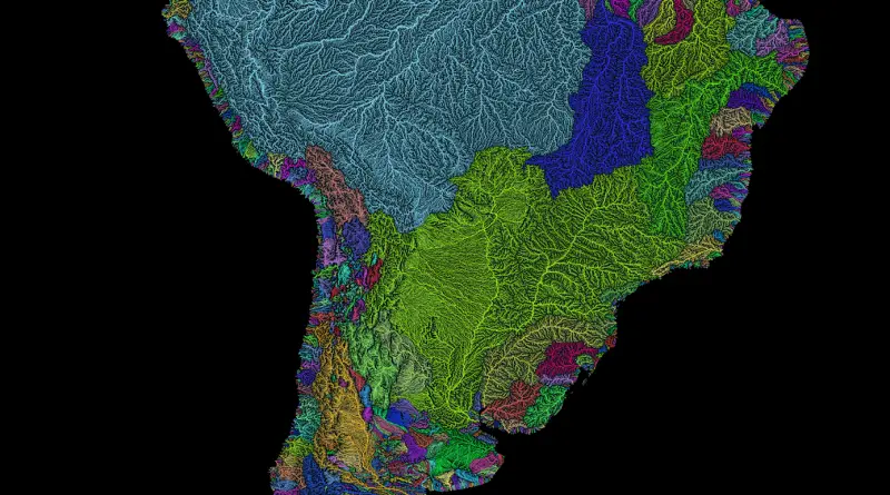
River basins of South America in rainbow colours
Via etsy.com Related posts: – River basins of Africa in rainbow colours – Rivers of Europe in rainbow colours –
Read More
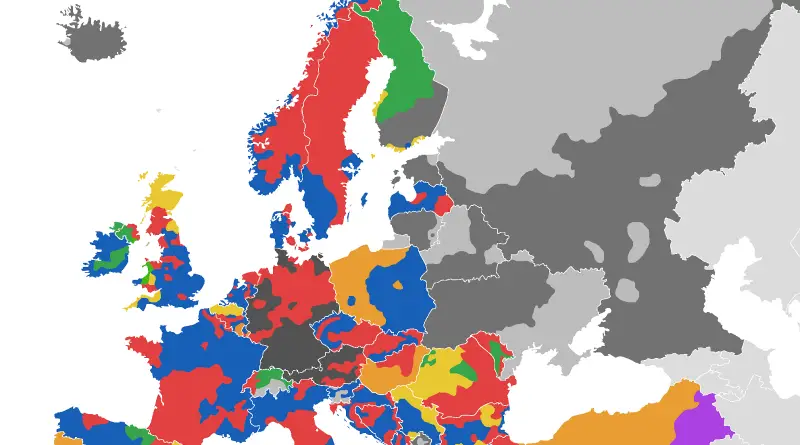
Voting Divisions in Europe (official color of dominant coalition/party shown)
Alexandr Trubetskoy (www.ispol.com) Related post: – Active separatist movements in Europe
Read MoreTopographic map of Greenland from bedrock elevation data
Greenland is the world’s largest island and the least densely populated country in the world. It is located in the northern part of the North American continent, between the Arctic Ocean and the North Atlantic Ocean. Greenland is an autonomous territory of Denmark, with its own government and parliament.
Read More