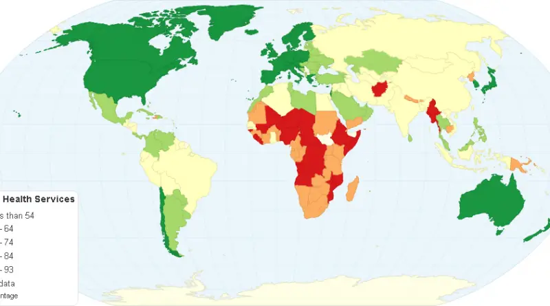
Basic Health Services by Country
Basic Health Services provided by Basic Health Staff are comprehensive health care services and health development of community depends on
Read More
Which cities value books the most?
The number libraries of every 100,000 in a city Number of bookshops per 100,000 Via www.spatialcarto.com
Read MoreUS States renamed after countries with similar GDPs (2015)
Related posts: – US’ individual GDPs compared to countries around the world (2015) – This map shows US states labeled
Read More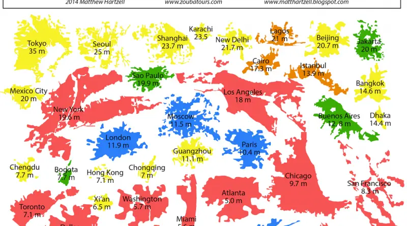
Global metropolitan urban area Footprints
Areas are drawn to reflect total urban built up area, including suburbs, and do not reflect municipal boundaries. Where one
Read MoreDangerous Items Confiscated at US airports (2015)
Transportation Security Administration confiscated a total of 22,044 dangerous items. Max Galka via Metrocosm
Read More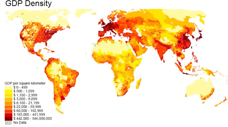
Distribution of World GDP Mapped
According to the World Bank is $93,864 trillion (2021). The U.S. is the World’s largest economy, with a GDP of about $22,675 trillion. China is the second-largest economy in the World ($16,642 trillion). Tuvalu is the World’s smallest economy, with a GDP of approximately $45 million.
Read More