How the Allies bombed Hitler and Nazis into submission
The animation was created by the Imperial War Museum to mark the re-opening of the American Air Museum. It shows
Read MoreThe animation was created by the Imperial War Museum to mark the re-opening of the American Air Museum. It shows
Read MoreMap showing each country’s number of Eurovision wins up to and including 2015. Number of Eurovision 2nd places of countries,
Read MoreWinter temperatures (December 2015-February 2016) compared to the 1981-2010 average. It was the contiguous U.S.’ warmest winter on record.
Read More3D print your favorite map tile. Enter your coordinates to generate an OBJ file that you can send to a
Read MoreRussian airstrikes were concentrated in areas held by rebels (yellow) who are not affiliated with the Islamic State (red) and
Read More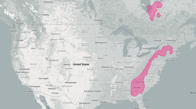
Norway may look slim on the globe, but it stretches 1,750 km north to south-long enough to cover Ireland to North Africa, or Vermont to Georgia.
Read MoreThe global number of McDonald’s restaurants rose from 40,031 in 2021 to 40,275 in 2022. Since 1997, the number of restaurants has increased year-over-year. More than 70 million people are served by the chain, which employs more than 1.7 million people.
Read More