
What Los Angeles would look like if all the ice caps melted
Map based on 260′ sea level rise. Aproximate sea level if all worlds ice sheet melted. JeFray Lim
Read more: What Los Angeles would look like if all the ice caps melted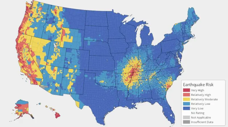
Earthquake hazard map for the U.S.
An Earthquake is shaking the Earth’s surface by energy waves emitted by drifting tectonic plates overcoming clash with one another underneath the Earth’s surface. Since 1900, earthquakes have taken place in 39 American States. The three U.S. states with the highest earthquake risk in the United States are Alaska, California, and Hawaii.
Read more: Earthquake hazard map for the U.S.