Date format by country
Via wikipedia.org
Read MoreVia wikipedia.org
Read More
Dive into the complex economic ecosystem of New York City through a series of revealing maps. From neighborhood-level economic indicators to mobility and opportunity insights, uncover the diverse economic stories of the Big Apple’s five boroughs.
Read More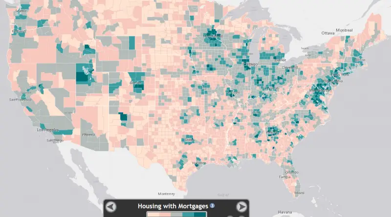
www.atlas.esri.com/Atlas/Housing_Atlas.html?t=2&m=1&x=-98.79&y=37.47&l=5 Part of the American Dream is owning your own home. This map shows the percentage of occupied housing that
Read More