Internet Users in Europe
The number of internet users in the Scandinavian countries has greatly outpaced the europe by comparison.
Read more: Internet Users in Europe
The number of internet users in the Scandinavian countries has greatly outpaced the europe by comparison.
Read more: Internet Users in EuropeNew psychological tests suggest that China’s history of rice farming has given the south more markers of traditional East Asian
Read more: Regional Patterns of Collectivism in China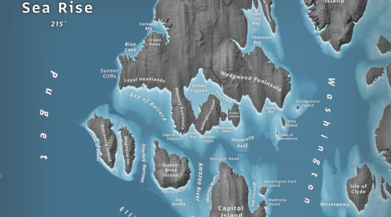
What happens to Seattle when 66 meters of water flood Puget Sound? Jeffrey Linn used LiDAR elevation data to map the city as an archipelago, where Capitol Hill becomes “Capitol Island” and the Space Needle turns into the “Sea Needle.” He created two versions with different cartographic styles.
Read more: Islands of SeattleWe may live in a world defined by invisible meta-data and the Cloud, but the roughly 3×5 inch paper booklet
Read more: How Powerful Is Your Passport?Data from satellite sensors show that during the Northern Hemisphere’s growing season, the Midwest region of the United States boasts
Read more: Satellite Shows High Productivity from U.S. Corn BeltUS economic growth in 2015 was strongest since 2005 (18.04 trillion USD (56,207.04 per capita)).
Read more: This map shows US states labeled as countries with similar GDPsTop 15 Largest Border Differences in USD (GDP per capita) Richer Country vs Poorer Country Qatar (102,100) – Saudi Arabia
Read more: Difference in GDP Per Capita Along The Worlds Borders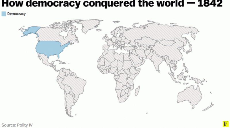
Democracy is a system of government in which the citizens exercise power directly or elect representatives from among themselves
Read more: How democracy conquered the worlduman skin color varies from the darkest brown to the lightest tints. Divergence induces distinctions in skin color among people in pigmentation, which comes from genetics and exposure to sunlight. Disparities across populations developed through natural selection because of environmental differences and regulated the biochemical impacts of ultraviolet radiation infiltrating the skin.
Read more: Human skin color distributionPlant Hardiness Zones for Canada. Related post: – Find cities with a similar climate
Read more: Plant Hardiness ZonesUnited States, Canada, Germany, Norway, Netherlands, Switzerland, Australia and New Zealand have the highest human development index score.
Read more: Countries by Human Development Index score– Nearly one in every five deaths of children under the age of five worldwide is due to a water-related
Read more: The countries facing the worst water shortagesThe map below show capital punishment laws of the world. Capital punishment laws of the world– abolished for all crimes
Read more: Death penalty legality by country