Global Remoteness
The maps are based on distance from cities, roads, railways, and airports. The green areas represent places where travel to the city, road and other transportation facilities can be measured in hundreds of kilometers.
Read More
The maps are based on distance from cities, roads, railways, and airports. The green areas represent places where travel to the city, road and other transportation facilities can be measured in hundreds of kilometers.
Read More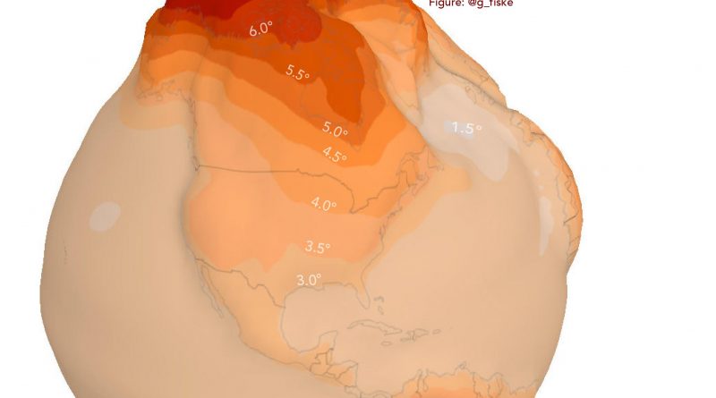
Over the past 30 years, the Arctic has warmed at roughly twice the rate as the entire globe, a phenomenon known as Arctic amplification. Most scientists agree that this rapid warming is a signal of human-caused climate change.
Read More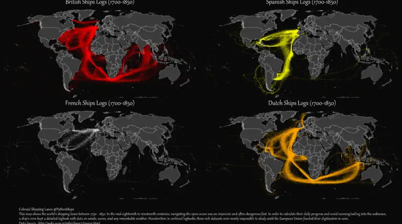
British colonial shipping lanes covered vast expanses, connecting the British Isles to North America, the Caribbean, South Asia, and the Pacific. Spanish lanes were primarily transatlantic, centered on the Atlantic Ocean and Caribbean. French routes spanned the Atlantic, Indian, and Pacific Oceans, reaching North America, the Caribbean, Southeast Asia, and the South Pacific. Dutch shipping lanes had a global reach, including the Indian and Pacific Oceans, with a strong presence in Southeast Asia and the East Indies.
Read More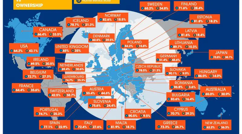
22 of 36 developed countries (61%) saw a decline in home ownership over the last 10 years. Today UK residents need at least two months’ average salary to purchase just one square meter of home.
Read More
The road system of the U.S. surpasses four million miles in combined length, plus numerous public line roads (8.3 million miles), other service roads, and off-road driving trails.
Read More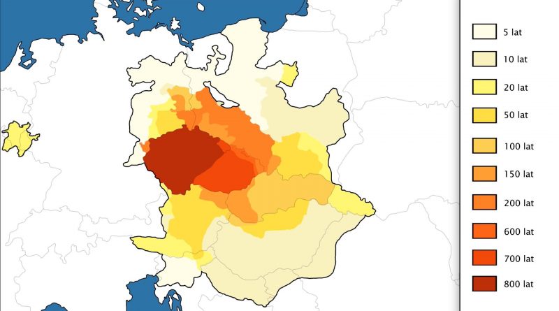
The territory of each country is changing through times. Each state in the world has reached its territorial peak, which then ends.
Read More
Due to the Coriolis effect, the dominant ocean currents in the North Atlantic move in a circle clockwise, delivering warm water from the Caribbean Sea to Europe, making Europe temperate instead of frozen like the same latitudes in North America. What would Earth look like if it rotated backward?
Read More
Autumn foliage is a phenomenon that changes the green leaves of deciduous trees. By the end of October, yellow, orange, red, and brown varieties dominate, showing the coming of peak fall foliage in the western and northern U.S. When it comes to the end of November, all except the southern counties of the U.S. are past the peak point.
Read More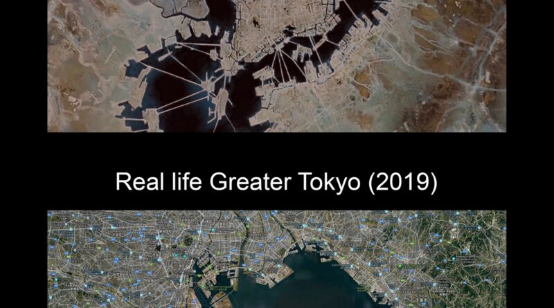
For Akira fans, this map puts Neo-Tokyo’s big artificial islands right next to real Tokyo Bay from 2019. It points out land that’s been built up since 1988, and compares things like area, people, skyscrapers, and the day-to-day mess in the film versus the real place.
Read More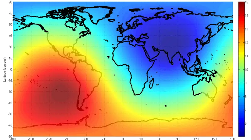
In demographics, the center of population is a geographical spot representing a center point of the region’s population. On average, the point nearest to everyone on our planet is in the north of South Asia, with a mean distance of 5,000 kilometers or 3,000 miles.
Read More