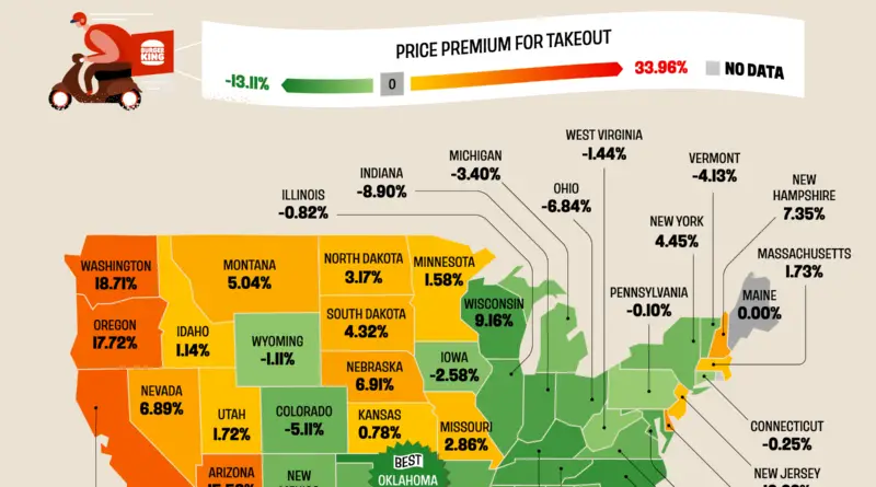
United States

Maps of the US

Historical Maps

The Forgotten Colonial Powers: New Netherland and New Sweden

Parts of what would become the eastern United States were ruled by two lesser-known European powers in the middle of the 17th century. Early American history was significantly shaped by the Dutch colony of New Netherland, which was centered on New Amsterdam (now New York City), and the Nordic outpost of New Sweden, which was located at the mouth of the Delaware River. Despite their brief period of independence, they have had a lasting impact on American architecture, language, and culture.

Read More
Physical maps

Most Impressive Landforms in Each U.S. state

The impressiveness of mountains and other landforms is inherently subjective. Regardless, two factors that universally contribute to the perceived impressiveness of a landform are its height and steepness. Height is a significant factor in defining impressiveness, but it’s not the only factor. For example, even though Mt. Elbert in Colorado (elevation: 4,399 meters or 14,432 ft) has a higher elevation than Grand Teton in Wyoming (elevation: 4199 meters or 13,776 ft), mountaineers can attest to Grand Teton looking considerably more impressive, as it rises much more steeply over the local landscape.

Read More