“Underground” routes to Canada (1896)
Map showing the lines of travel of fugitive slaves in 1896.
Read MoreMap showing the lines of travel of fugitive slaves in 1896.
Read MoreMap of US States and Canadian Provinces showing the distribution of Times Top 500 Universities. Reddit user: whistleridge
Read MorePercentage of people 15 years or older who smoke according to the World Health Organization (2015). Reddit user: fraillimbnursery
Read MoreDive into the fascinating world of legal professionals with our comprehensive analysis of lawyers per capita in the United States and Canada. Uncover which states and provinces have the highest and lowest concentrations of lawyers, explore historical trends, and understand the factors driving the distribution of legal talent. From Washington D.C.’s unmatched density to the educational paths required to become a lawyer, this article provides a detailed look at the legal landscape across North America.
Read MoreSource: metricmaps.org
Read MoreSource: metricmaps.org
Read MoreReddit user: Mainstay17
Read More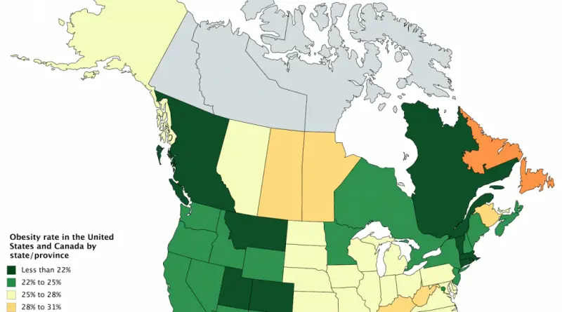
Reddit user: fraillimbnursery Related post: – Obesity prevalence in the United States
Read Morewww.bldgblog.com 1. Living Cost DifferentialThis line relates to Urbanism and Resources. 2. Task Force LineThis line relates to Mobility and
Read More