The Contested Crown: Britain’s Ever-Changing Second City
From industrial giants to imperial centers, discover the remarkable cities that have competed for the prestigious “Second City” status throughout British history.
Read More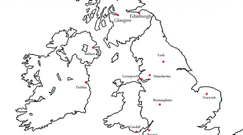
From industrial giants to imperial centers, discover the remarkable cities that have competed for the prestigious “Second City” status throughout British history.
Read More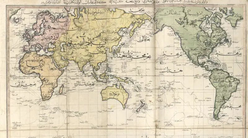
Take a closer look at the fascinating history of Ottoman mapmaking, from Piri Reis’s remarkable works to the empire’s shift toward modern European techniques.
Read More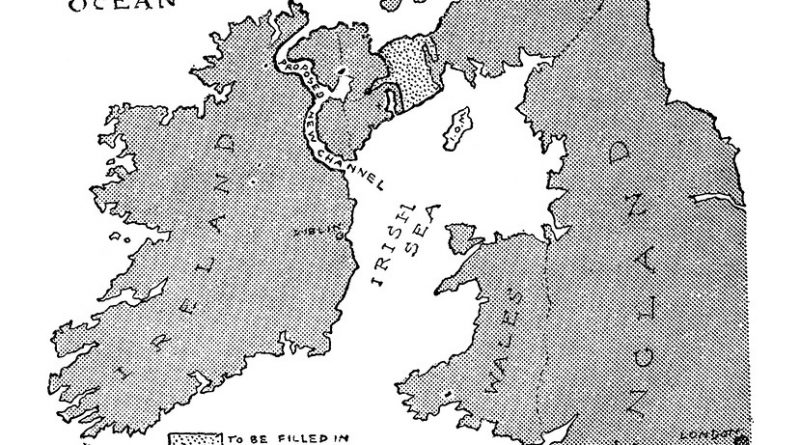
In 1913, a satirical map humorously suggested a land bridge and canal between Scotland and Ireland to address Ireland’s division.
Read More
Unveil the top-rated tourist spots in each UK county. Whether you’re a history buff, nature lover, or culture enthusiast, our guide highlights must-visit attractions that showcase the rich diversity of the United Kingdom.
Read More
A 2005 study by the Imperial College London’s Carol Propper revealed disparities in England hospital access, based on patient population. The
Read More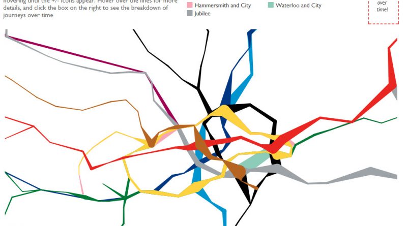
Ever wondered where people actually get on and off the London Underground? This fascinating data visualization maps it out with real passenger data, offering insights into the city’s busiest stations and the hidden geography of movement beneath London.
Read More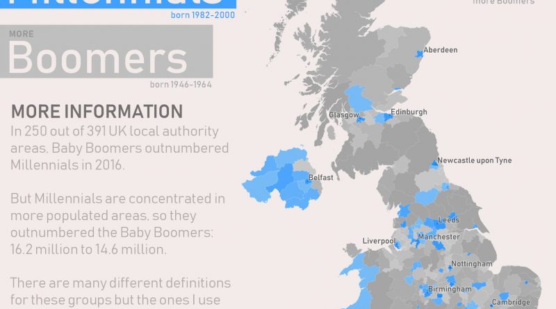
The UK map shows where Millennials outnumber Baby Boomers—and why it matters. Explore the population trends behind this generational geography.
Read More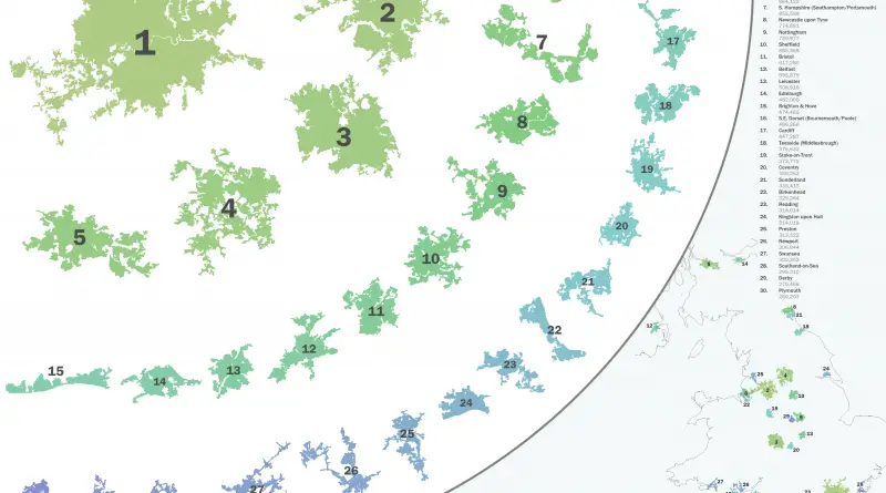
How big is Greater London compared to other UK cities—or global giants like Tokyo and New York? This post ranks the top 30 built-up areas in Britain.
Read More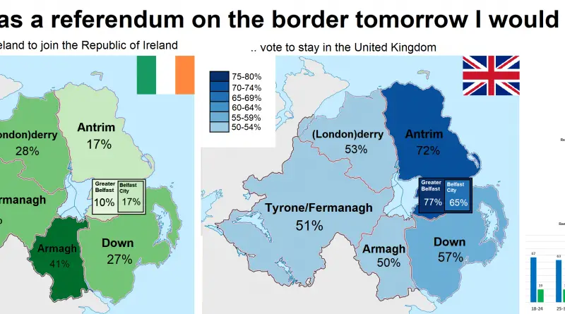
A 2016 map illustrates Northern Ireland’s regional perspectives on a potential border referendum, revealing the complexities of public opinion.
Read More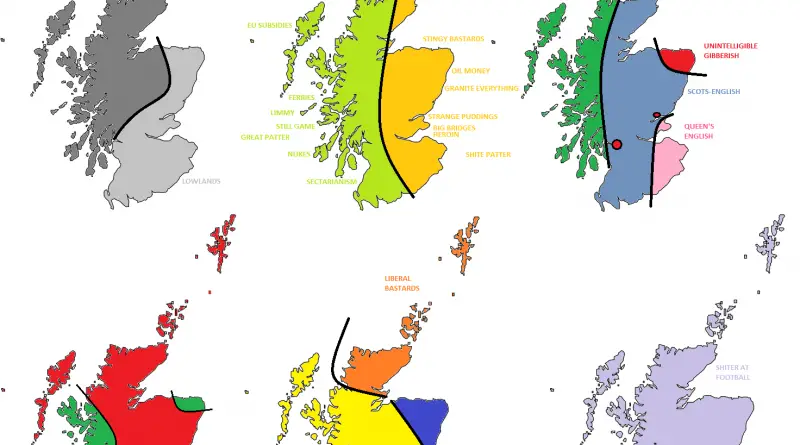
The UK as you’ve never seen it: divided by accents, snacks, and politics. These maps are full of dry humor and local stereotypes.
Read More