United States
Maps of the US
Coast Survey Nautical Chart of Map of New York City & Harbor (1866)
Related posts: – Urban Scratchoff – Interactive map of New York City in year 1609 – Map of Manhattan by
Read MoreSan Francisco: An isochronous map for public transportation
Given a starting point it shows what you can reach within a certain time limit using public transportation (so subway,
Read MoreThe vote across the Mexican border
Via elpais.com Related posts: – U.S. counties in which party of top vote-getter changed between 2000 & 2016 presidential elections
Read More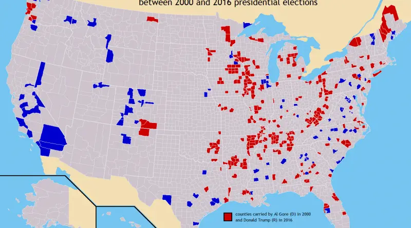
U.S. counties in which party of top vote-getter changed between 2000 & 2016 presidential elections
Related posts: – U.S. Presidential Election 2016 (Cartogram) – How America voted in every election (1824 – 2016) – The
Read MoreThe disappearance of San Francisco’s middle-class neighborhoods (1990 – 2010)
Related posts: – Mapping Displacement and Gentrification in the San Francisco Bay Area – America’s great housing divide: Are you
Read More