United States
Maps of the US
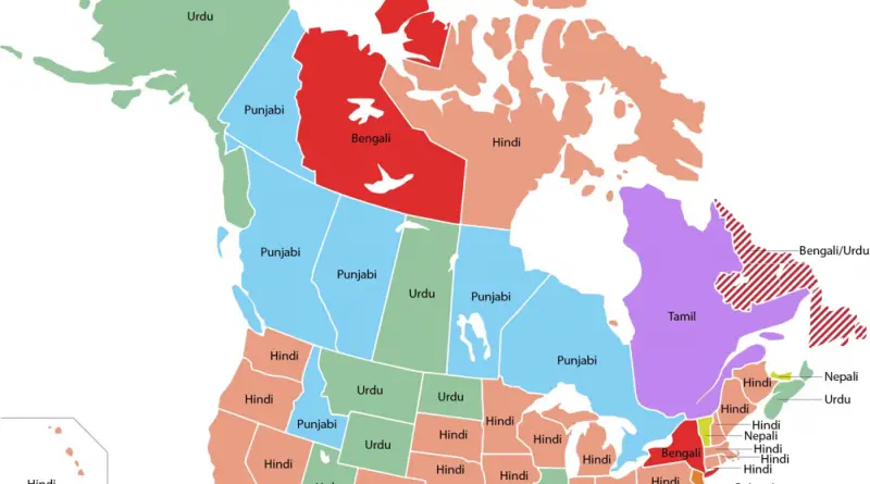
Most Commonly Spoken South Asian Language in the US & Canada
Related post: – Most Commonly Spoken Scandinavian Language in US States
Read MoreNew York’s Subway Deserts
Relates posts: – New York City boroughs journey to work-driving ca alone vs. walk/public transportation – New York City transit
Read MoreThe 2016 Democratic and Republican Primaries: Every Day
The progress of the 2016 Democratic Primaries each day as well as the voting margins of every county that voted.
Read More
CrimeTeller: Crime street view
Crime Teller provides a crime map at street level. It uses a new geographic information system (GIS) technology. You can
Read MoreWhere did recent gas price declines affect consumers the most?
How falling gas prices fuel the consumer interactive map. Via JPMorgan Chase Institute
Read More
Where are there more Gun Stores vs. Grocery Stores in the U.S.?
Related posts: – Firearms vs. Frappuccinos – Gun sales in the U.S. – Online gun sales in major U.S. cities
Read More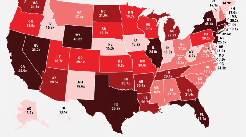
Ratio of average top 1% income to average bottom 99% income
Via Business Insider Related post: – Mapping Average Income of the Top 1%
Read More