Pedestrian time analysis
Click into the map and in a blink the walk-time from/to the clicked location is displayed, the so-called pedestrian isochrone.
Read MoreClick into the map and in a blink the walk-time from/to the clicked location is displayed, the so-called pedestrian isochrone.
Read More
Related posts: – The city of Edmonton building age map
Read MoreAccording to seattletimes.com Among the 50 biggest U.S. cities, Seattle ranks No. 3 on the “geographic diversity index” with a
Read MoreThis site gives you a clever way to explore historical aerial imagery of New York City. You can click and
Read MoreThe heart of the New York metropolitan area, Manhattan traces its roots to a trading post established by settlers from the Dutch Republic in 1624; the trading post was called New Amsterdam. Historically, Manhattan has been bought by Dutch settlers from Lenape Native Americans for 60 guilders (~$1059 in contemporary terms). The area and its neighborhoods came under the English administration in 1664 and were renamed New York.
Read More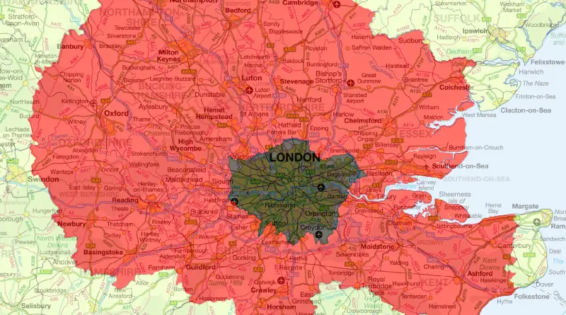
The whole area (including Greater London itself) contains 18.9 million people – more than a third of the population of
Read MoreSeth Kadish compares the street grids of two dozen urban centers across the United States and Europe. The tallest bar
Read MoreOne-bedroom prices with Year-over-Year changes shown. Relates posts: – Map of Manhattan by Joan Vinckeboons (1639) – A map of
Read More