Istanbul urban database
Istanbul urban database is an ongoing digital humanities project, digitizing and visualizing the historic urban archives of Istanbul. Istanbul Urban
Read more: Istanbul urban database
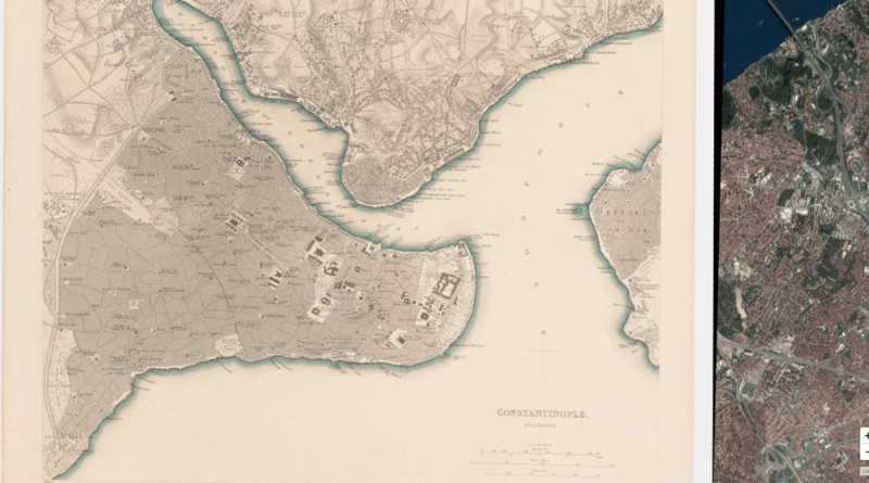
Istanbul urban database is an ongoing digital humanities project, digitizing and visualizing the historic urban archives of Istanbul. Istanbul Urban
Read more: Istanbul urban database220 metro & light rail systems from around the world, shrunken & simplified.
Read more: Metro systems from New York to Tokyo, shrunken and simplifiedUnderstanding and promoting urban tree cover has never been more important Increasing a city’s tree canopy contributes to lowering urban
Read more: Treepedia: Mapping Urban Trees in U.S. CitiesThe Atlas of ReUrbanism is a tool to understand, support, and transform American cities. Developed by the Preservation Green
Read more: The Atlas of ReUrbanismAlthough many argue that cities around the world are moving towards automobile-dominant, low-density sprawl, a comparison of the Toronto region
Read more: Comparing Metropolitan Form, Density & Transit Systems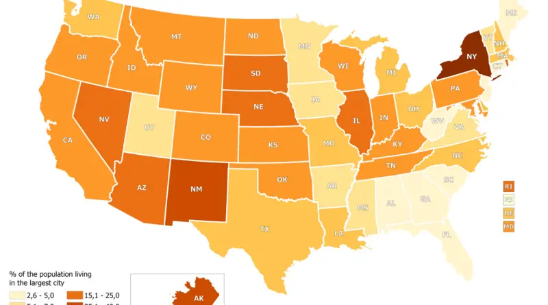
In most U.S. states, less than 20 percent of the population lives in the largest city. In South Carolina and West Virginia, even less than 3% of the population lives in the largest city. The highest percentage of the state’s population lives in New York City (New York) – 41.30% and Anchorage (Alaska) – 39.52%.
Read more: Percentage of U.S. state population living in state capital metropolitan area and its Most Populous City
San Francisco Los Angeles New York City
Read more: 3D Population Density InspectorLondon Liverpool Edinburgh Glasgow Los Angeles New York City Washington Via gisforthought.com
Read more: Crowdsourced City Extents