Continents with Economy Smaller than Japan
A 2017 map shows something surprising: Japan’s economy was bigger than South America’s, Africa’s, or Oceania’s.
Read more: Continents with Economy Smaller than Japan
Maps to explain economic geography.
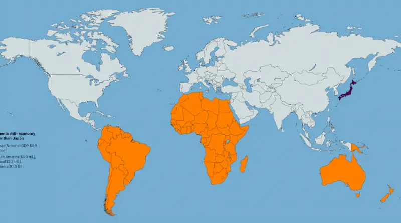
A 2017 map shows something surprising: Japan’s economy was bigger than South America’s, Africa’s, or Oceania’s.
Read more: Continents with Economy Smaller than JapanSource: facebook.com A tax wedge or tax on labor is the difference between before-tax and after-tax wages. The tax wedge
Read more: European countries by total burden on labor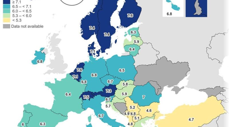
A Eurostat survey asked Europeans how satisfied they are with their personal finances. The results vary sharply across the continent, with northern countries rating their situations higher than many in the south and east. What drives these differences, and how does income distribution play a role?
Read more: Financial satisfaction in Europe — how people judge their household finances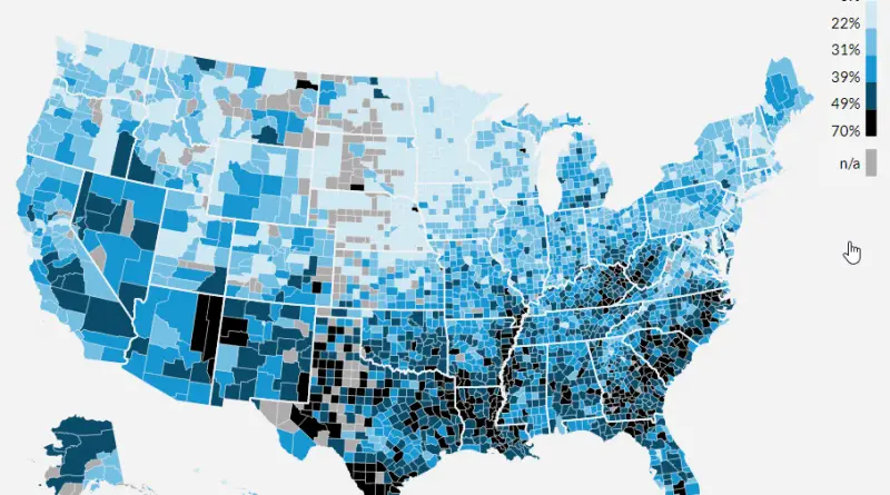
Which US states saw household debt skyrocket relative to income over the past 25 years? The answer might surprise you. Delaware leads with a stunning 105% increase, while some states like California actually saw their ratios improve.
Read more: Household Debt-to-Income Ratios by US State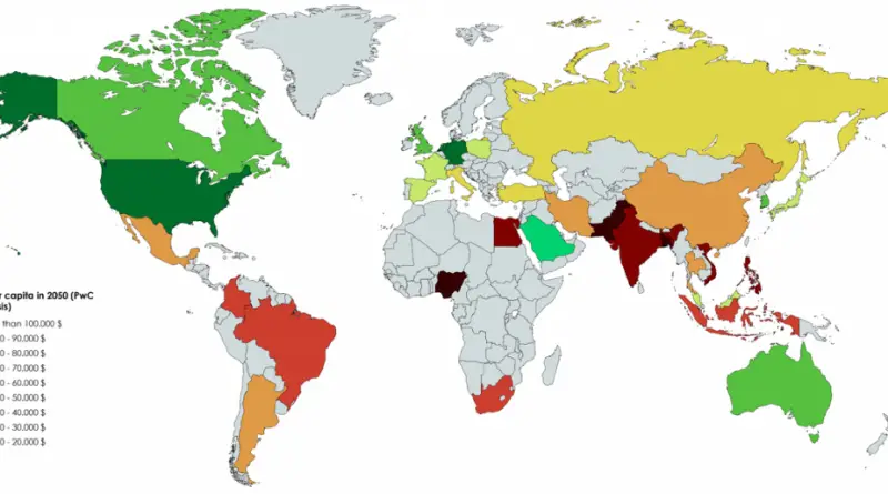
Latest long-term global growth projections to 2050 for 32 of the largest economies in the world, accounting for around 85%
Read more: GDP per capita of largest world economies (2050)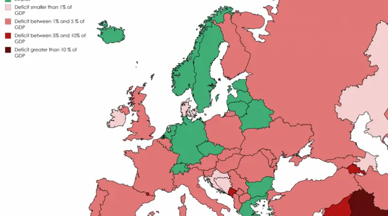
The difference between national government revenues and expenditures expressed as a percent of the Gross Domestic Product. A positive number
Read more: Budget surplus or deficit in European countries (2016)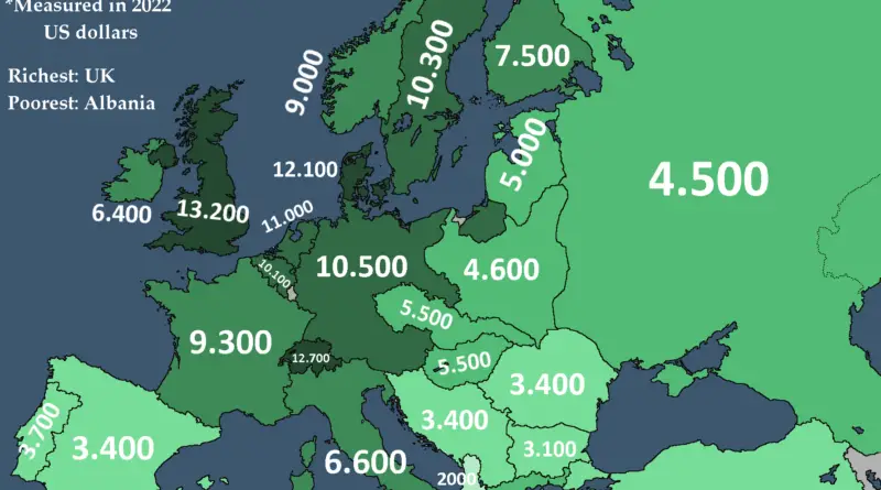
In 1938, the year before WW2, the United States had, by far, the largest economy worldwide in terms of GDP. The 5 Allied Great Powers that arose victorious from the war and the 3 Axis Tripartite Pact nations that were eventually defeated made up the 8 largest sovereign economies in 1938.
Read more: Economic Power Before World War II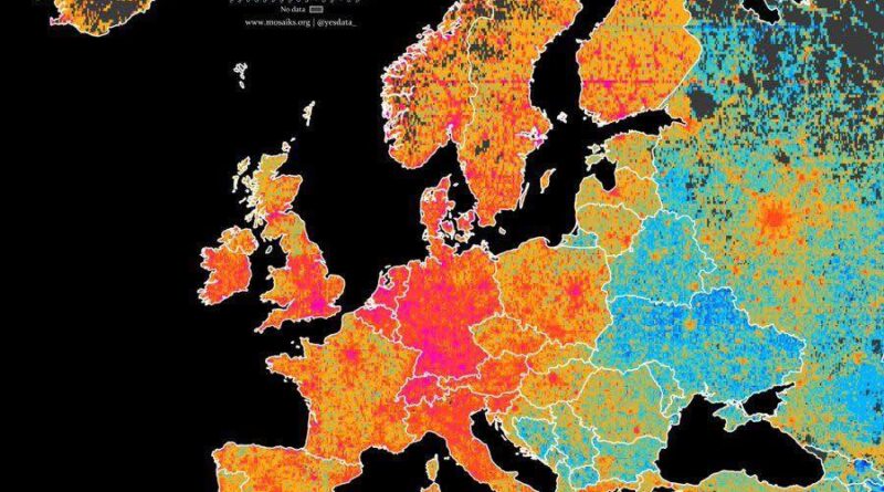
Europe is one continent, but in development terms it behaves more like several. From Iceland and Norway at the top of global human development rankings to Moldova and war-affected Ukraine at the other end, the differences in living standards, education, and life expectancy are significant. Why does the gap exist, and where is it actually getting smaller?
Read more: Regional Development Across Europe Mapped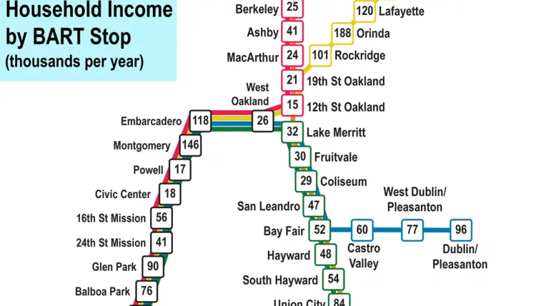
Fifty BART stations, fifty very different paychecks. Here is what Census data shows about household income near each stop.
Read more: Median Household Income by BART Station Across the Bay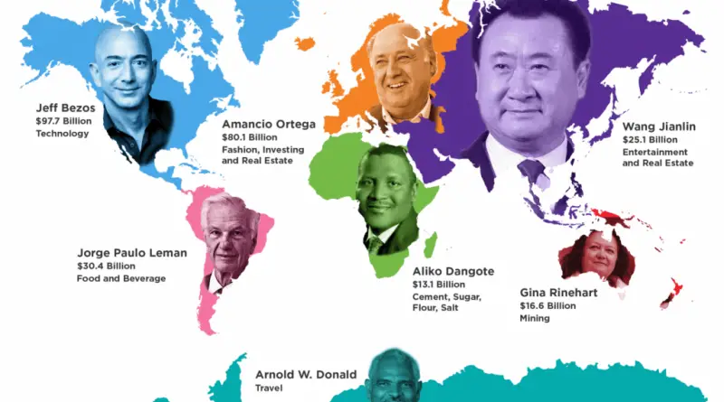
North America has produced the world’s richest person in 29 of the last 31 years, and Bill Gates alone accounts for 17 of them.
Read more: North America Has Produced the World’s Richest Person in 29 of the Last 31 Years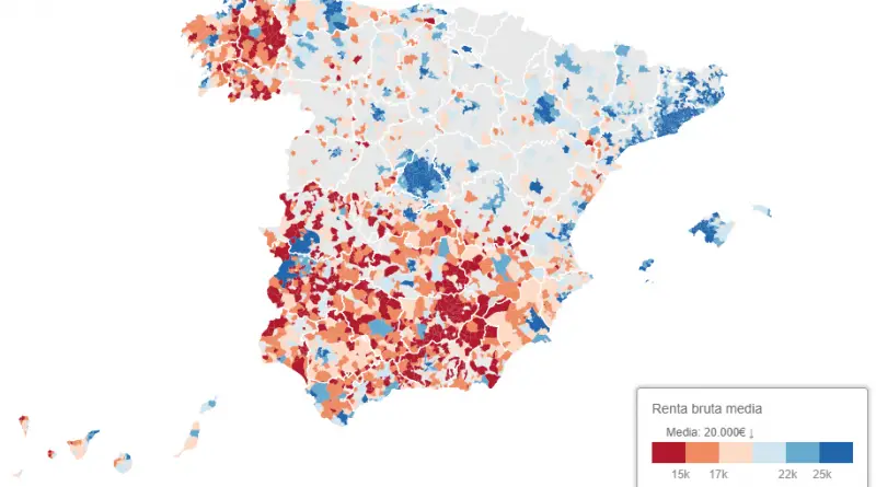
Spain Tax Agency show the significant wealth gap between the rich north and the humble south. People who live in cities
Read more: Evaluating the urban-rural wealth gap in SpainAverage income per household divided by the number of people per household. Most of the poor people don’t live in
Read more: Median Income in French communes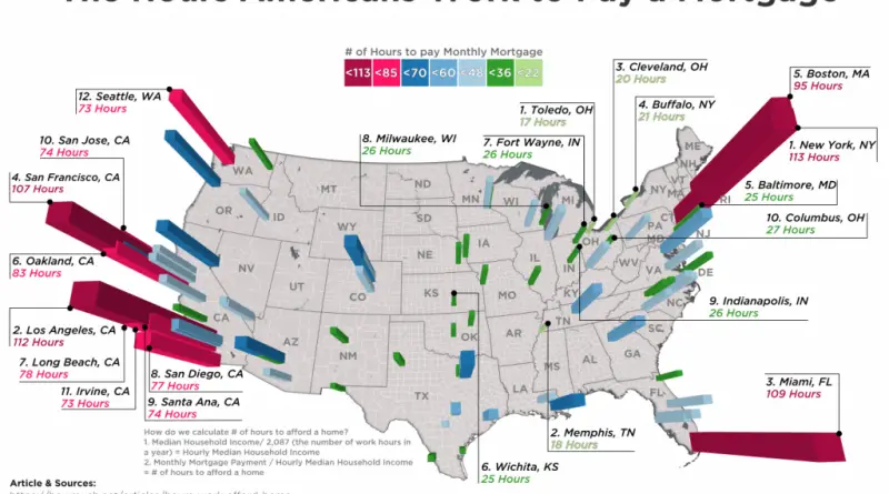
The median income for people in 98 of the biggest cities in the United States was taken from the US
Read more: How many hours Americans need to work to pay their mortgage